King County, Washington
King County | ||
|---|---|---|
 City Hall Park and King County Courthouse in downtown Seattle | ||
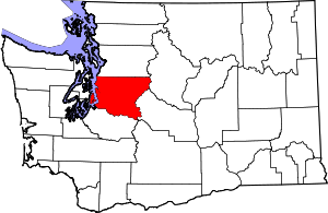
 Location within the U.S. state of Washington | ||
 Washington's location within the U.S. | ||
| Coordinates: 47°28′N 121°50′W / 47.47°N 121.84°W | ||
| Country | ||
| State | ||
| Founded | December 22, 1852 | |
| Named for |
| |
| Seat | Seattle | |
| Largest city | Seattle | |
| Area | ||
| • Total | 2,307 sq mi (5,980 km2) | |
| • Land | 2,116 sq mi (5,480 km2) | |
| • Water | 191 sq mi (490 km2) 8.3% | |
| Population (2020) | ||
| • Total | 2,269,675 | |
| • Density | 980/sq mi (380/km2) | |
| Time zone | UTC−8 (Pacific) | |
| • Summer (DST) | UTC−7 (PDT) | |
| Congressional districts | 1st, 7th, 8th, 9th | |
| Website | www | |
King County is a county in the U.S. state of Washington. The population was 2,269,675 in the 2020 census. King is the most populous county in Washington. The county seat is Seattle,[1] which is the state's largest city.
King County is one of three Washington counties that are included in the Seattle–Tacoma–Bellevue metropolitan statistical area. About two-thirds of King County's population lives in Seattle's suburbs.
References[change | change source]
- ↑ "Court Directory: County-City Reference List". Washington Courts. Retrieved 2017-05-07.


