
La Crosse, Kansas
La Crosse, Kansas | |
|---|---|
City and County seat | |
 Welcome Sign (2010) | |
 Location within Rush County and Kansas | |
 | |
| Coordinates: 38°31′55″N 99°18′34″W / 38.53194°N 99.30944°W[1] | |
| Country | United States |
| State | Kansas |
| County | Rush |
| Founded | 1876 |
| Incorporated | 1886 |
| Named for | La Crosse, Wisconsin |
| Area | |
| • Total | 1.04 sq mi (2.68 km2) |
| • Land | 1.04 sq mi (2.68 km2) |
| • Water | 0.00 sq mi (0.00 km2) |
| Elevation | 2,057 ft (627 m) |
| Population | |
| • Total | 1,266 |
| • Density | 1,200/sq mi (470/km2) |
| Time zone | UTC-6 (CST) |
| • Summer (DST) | UTC-5 (CDT) |
| ZIP codes | 67548, 67553 |
| Area code | 785 |
| FIPS code | 20-37500 |
| GNIS ID | 2395563[1] |
| Website | cityoflacrosseks.com |
La Crosse is a city in Rush County, Kansas, United States.[4] It is also the county seat of Rush County. In 2020, 1,266 people lived there.[3] La Crosse calls itself the "Barbed Wire capital of the world."[5]
History[change | change source]
La Crosse was created in 1876. It was named after the city of La Crosse, Wisconsin.[6] La Crosse subsequently became the intended county seat, and county records were transferred there from the temporary county seat, nearby Rush Center. A county seat war ensued between the two communities, lasting until La Crosse was declared the permanent county seat and the construction of the county courthouse in 1888.[7]
In the 1960s, La Crosse became a regional center of barbed wire collecting, leading to the establishment of the Kansas Barbed Wire Museum and the nicknaming of the city as "The Barbed Wire Capital of the World".[8]
Tornado of 2012[change | change source]
On May 25, 2012, an EF-1 tornado caused about four blocks of a lot of damage, and two businesses were destroyed. A third of the businesses had very bad damage. There were no injuries.[9]
Geography[change | change source]
La Crosse is at 38°31′55″N 99°18′31″W / 38.53194°N 99.30861°W (38.532014, -99.308614). It has an elevation of 2,057 feet (627 m).[10][11] It is in the Smoky Hills region of the Great Plains. It is about 12 miles (19 km) south of the Smoky Hill River and 5 miles (8.0 km) north of Walnut Creek, which is a tributary of the Arkansas River.[12][13] Sand Creek, a tributary of Walnut Creek, goes southeast around the southwestern and southern parts of the city. Mule Creek, a small tributary of Sand Creek, flows southeast through the city.[13] It is in west-central Kansas at the intersection of U.S. Route 183 and K-4. La Crosse is 125 miles (201 km) northwest of Wichita, 261 miles (420 km) west-southwest of Kansas City, and 314 miles (505 km) east-southeast of Denver.[12][14]
The United States Census Bureau says that the city has a total area of 1.04 square miles (2.69 km2). All of it is land.[2]
Weather[change | change source]
On average in La Crosse, July is the hottest month, January is the coldest month, and May is the wettest month. The hottest temperature ever in La Crosse was 115 °F (46 °C) in 1954; the coldest temperature ever was -24 °F (-31 °C) in 1989.[15]
| Climate data for La Crosse, Kansas | |||||||||||||
|---|---|---|---|---|---|---|---|---|---|---|---|---|---|
| Month | Jan | Feb | Mar | Apr | May | Jun | Jul | Aug | Sep | Oct | Nov | Dec | Year |
| Record high °F (°C) | 81 (27) |
86 (30) |
95 (35) |
103 (39) |
107 (42) |
112 (44) |
115 (46) |
114 (46) |
112 (44) |
100 (38) |
89 (32) |
83 (28) |
115 (46) |
| Average high °F (°C) | 41 (5) |
47 (8) |
57 (14) |
67 (19) |
76 (24) |
87 (31) |
94 (34) |
92 (33) |
83 (28) |
72 (22) |
55 (13) |
44 (7) |
68 (20) |
| Average low °F (°C) | 15 (−9) |
19 (−7) |
28 (−2) |
38 (3) |
50 (10) |
60 (16) |
65 (18) |
63 (17) |
54 (12) |
41 (5) |
27 (−3) |
19 (−7) |
40 (4) |
| Record low °F (°C) | −23 (−31) |
−17 (−27) |
−23 (−31) |
9 (−13) |
21 (−6) |
36 (2) |
43 (6) |
42 (6) |
23 (−5) |
14 (−10) |
−8 (−22) |
−24 (−31) |
−24 (−31) |
| Average precipitation inches (mm) | 0.66 (17) |
0.83 (21) |
2.09 (53) |
2.27 (58) |
3.65 (93) |
3.35 (85) |
3.40 (86) |
2.55 (65) |
1.88 (48) |
1.42 (36) |
1.22 (31) |
0.76 (19) |
24.08 (612) |
| Source: The Weather Channel[15] | |||||||||||||
People[change | change source]
| Historical population | |||
|---|---|---|---|
| Census | Pop. | %± | |
| 1890 | 513 | — | |
| 1900 | 536 | 4.5% | |
| 1910 | 806 | 50.4% | |
| 1920 | 808 | 0.2% | |
| 1930 | 1,355 | 67.7% | |
| 1940 | 1,407 | 3.8% | |
| 1950 | 1,769 | 25.7% | |
| 1960 | 1,767 | −0.1% | |
| 1970 | 1,583 | −10.4% | |
| 1980 | 1,618 | 2.2% | |
| 1990 | 1,427 | −11.8% | |
| 2000 | 1,376 | −3.6% | |
| 2010 | 1,342 | −2.5% | |
| 2020 | 1,266 | −5.7% | |
| U.S. Decennial Census | |||
2020 census[change | change source]
The 2020 census says that there were 1,266 people, 547 households, and 318 families living in La Crosse. Of the households, 73.5% owned their home and 26.5% rented their home.
The median age was 45.6 years. Of the people, 94.8% were White, 0.3% were Black, 0.3% were Asian, 0.1% were Native American, 0.7% were from some other race, and 3.8% were two or more races. Hispanic or Latino of any race were 4.7% of the people.[3][16]
2010 census[change | change source]
The 2010 census says that there were 1,342 people, 606 households, and 350 families living in La Crosse.[17]
Education[change | change source]
La Crosse Public Schools (USD 395) controls three schools in the city.[18][19]
Infrastructure[change | change source]
Transportation[change | change source]
Rush County Airport is northeast of the city. It is on the north side of K-4.[13] It is publicly owned. It has one runway. It is used for general aviation.[20]
A railroad of the Kansas and Oklahoma Railroad goes southeast-northwest through La Crosse.[13]
Media[change | change source]
The Rush County News is the local newspaper. It is published once per week in La Crosse.[21]
La Crosse is in the Wichita-Hutchinson, Kansas television market.[22]
References[change | change source]
- ↑ 1.0 1.1 1.2 U.S. Geological Survey Geographic Names Information System: La Crosse, Kansas
- ↑ 2.0 2.1 "2020 U.S. Gazetteer Files". United States Census Bureau. Retrieved December 3, 2023.
- ↑ 3.0 3.1 3.2 "DP1: PROFILE OF GENERAL POPULATION AND HOUSING CHARACTERISTICS". United States Census Bureau. Retrieved December 3, 2023.
- ↑ "Find a County". National Association of Counties. Retrieved 2011-06-07.
- ↑ Griffin, Pete (May 26, 2011). "What's In a Name? Slogans Can Make or Break a City, Experts Say". Fox News. Retrieved March 19, 2014.
- ↑ "Profile for La Crosse, Kansas". ePodunk. Archived from the original on 14 July 2014. Retrieved 22 June 2014.
- ↑ "Welcome to Rush County, Kansas..." Rush County, Kansas. Retrieved 2011-06-24.
- ↑ "The History of the Kansas Barbed Wire Museum". Kansas Barbed Wire Museum. Retrieved 2011-06-24.
- ↑ La Crosse residents continue to clean up after twister ; KWCH; May 27, 2012.
- ↑ "US Board on Geographic Names". United States Geological Survey. 2007-10-25. Retrieved 2008-01-31.
- ↑ "US Gazetteer files: 2010, 2000, and 1990". United States Census Bureau. 2011-02-12. Retrieved 2011-04-23.
- ↑ 12.0 12.1 "2003-2004 Official Transportation Map" (PDF). Kansas Department of Transportation. 2003. Retrieved 2011-06-22.
- ↑ 13.0 13.1 13.2 13.3 "General Highway Map - Rush County, Kansas" (PDF). Kansas Department of Transportation. 2010-10-01. Retrieved 2011-06-22.
- ↑ "City Distance Tool". Geobytes. Archived from the original on 2010-10-05. Retrieved 2011-06-22.
- ↑ 15.0 15.1 "Average weather for La Crosse, KS". The Weather Channel. Archived from the original on 2014-08-09. Retrieved 2011-06-22.
- ↑ "P16: HOUSEHOLD TYPE". United States Census Bureau. Retrieved December 31, 2023.
- ↑ "American FactFinder". United States Census Bureau. Retrieved 2012-07-06.
- ↑ "La Crosse Public Schools". La Crosse USD 395. Retrieved 2011-06-24.
- ↑ "La Crosse, Kansas". City-Data. Retrieved 2011-06-24.
- ↑ "K94 - Rush County Airport". AirNav.com. Retrieved 2011-06-22.
- ↑ "About this Newspaper: The Rush County news". Chronicling America. Library of Congress. Retrieved 2011-06-24.
- ↑ "Kansas TV Markets". EchoStar Knowledge Base. Archived from the original on 2011-07-26. Retrieved 2011-06-24.
Other websites[change | change source]
- City
- Schools
- USD 395, local school district
- Historical
- History of Cities in Rush County
- La Crosse Info, Legends of Kansas
- Maps
- La Crosse City Map, KDOT
Municipalities and communities of Rush County, Kansas, United States | ||
|---|---|---|
| Cities | 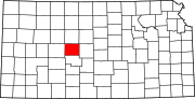 | |
| Unincorporated communities | ||
| Ghost towns | ||
| International | |
|---|---|
| National | |