
Lastrup
Lastrup | |
|---|---|
 Flag  Coat of arms | |
Location of Lastrup within Cloppenburg district 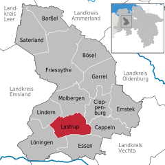 | |
 Lastrup  Lastrup | |
| Coordinates: 52°46′N 7°50′E / 52.767°N 7.833°E | |
| Country | Germany |
| State | Lower Saxony |
| District | Cloppenburg |
| Subdivisions | 14 districts |
| Government | |
| • Mayor (2018–23) | Michael Kramer[1] (CDU) |
| Area | |
| • Total | 85 km2 (33 sq mi) |
| Elevation | 45 m (148 ft) |
| Population (2021-12-31)[2] | |
| • Total | 7,315 |
| • Density | 86/km2 (220/sq mi) |
| Time zone | UTC+01:00 (CET) |
| • Summer (DST) | UTC+02:00 (CEST) |
| Postal codes | 49688 |
| Dialling codes | 0 44 72 0 44 77 (Lastrup-Hemmelte) |
| Vehicle registration | CLP |
| Website | www.lastrup.de |
Lastrup is a municipality in Cloppenburg, in Lower Saxony, Germany. It is about 15 km southwest of Cloppenburg.
References[change | change source]
- ↑ "Verzeichnis der direkt gewählten Bürgermeister/-innen und Landräte/Landrätinnen". Landesamt für Statistik Niedersachsen. April 2021.
- ↑ "LSN-Online Regionaldatenbank, Tabelle A100001G: Fortschreibung des Bevölkerungsstandes, Stand 31. Dezember 2021" (in German). Landesamt für Statistik Niedersachsen.
Towns and municipalities in Cloppenburg (district) | ||
|---|---|---|
 | ||
| International | |
|---|---|
| National | |