
Lincoln County, Mississippi
Lincoln County | |
|---|---|
 Postcard Brookhaven City Hall, early 20th century. | |
 Location within the U.S. state of Mississippi | |
 Mississippi's location within the U.S. | |
| Coordinates: 31°32′N 90°27′W / 31.54°N 90.45°W | |
| Country | |
| State | |
| Founded | 1870 |
| Named for | Abraham Lincoln |
| Seat | Brookhaven |
| Largest city | Brookhaven |
| Area | |
| • Total | 588 sq mi (1,520 km2) |
| • Land | 586 sq mi (1,520 km2) |
| • Water | 2.1 sq mi (5 km2) 0.4% |
| Population (2020) | |
| • Total | 34,907 |
| • Density | 59/sq mi (23/km2) |
| Time zone | UTC−6 (Central) |
| • Summer (DST) | UTC−5 (CDT) |
| Congressional district | 3rd |
| Website | www |
Lincoln County is a county in the U.S. state of Mississippi. As of the 2020 census, 34,907 people lived there.[1] Its county seat is Brookhaven.[2] The county was created on April 7, 1870 and named for Abraham Lincoln, 16th President of the United States (1861–1865).[3]
References[change | change source]
- ↑ "QuickFacts: Lincoln County, Mississippi". United States Census Bureau. Retrieved January 4, 2024.
- ↑ "Find a County". National Association of Counties. Retrieved 2011-06-07.
- ↑ Gannett, Henry (1905). The Origin of Certain Place Names in the United States. U.S. Government Printing Office. p. 187.
Municipalities and communities of Lincoln County, Mississippi, United States | ||
|---|---|---|
| Cities | 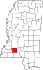 | |
| Town | ||
| CDPs | ||
| Other unincorporated communities | ||
| Ghost town | ||
| Footnotes | ‡This populated place also has portions in an adjacent county or counties | |