
Lowndes County, Mississippi
Lowndes County | |
|---|---|
 Friendship Cemetery | |
 Location within the U.S. state of Mississippi | |
 Mississippi's location within the U.S. | |
| Coordinates: 33°28′N 88°26′W / 33.47°N 88.44°W | |
| Country | |
| State | |
| Founded | 1830 |
| Named for | William Jones Lowndes |
| Seat | Columbus |
| Largest city | Columbus |
| Area | |
| • Total | 516 sq mi (1,340 km2) |
| • Land | 506 sq mi (1,310 km2) |
| • Water | 11 sq mi (30 km2) 2.1% |
| Population (2020) | |
| • Total | 58,879 |
| • Density | 110/sq mi (44/km2) |
| Time zone | UTC−6 (Central) |
| • Summer (DST) | UTC−5 (CDT) |
| Congressional district | 1st |
| Website | lowndescountyms |
Lowndes County is a county in the U.S. state of Mississippi. As of the 2020 census, 58,879 people lived there.[1] Its county seat is Columbus.[2] The county is named for U.S. Congressman William Jones Lowndes.[3]
Mississippi University for Women is located here.
References[change | change source]
- ↑ "QuickFacts: Lowndes County, Mississippi". United States Census Bureau. Retrieved January 4, 2024.
- ↑ "Find a County". National Association of Counties. Retrieved 2011-06-07.
- ↑ Gannett, Henry (1905). The Origin of Certain Place Names in the United States. U.S. Government Printing Office. p. 191.
Municipalities and communities of Lowndes County, Mississippi, United States | ||
|---|---|---|
| City | 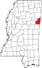 | |
| Towns | ||
| CDPs | ||
| Unincorporated communities | ||
| Ghost towns | ||