Majadahonda
Majadahonda | |
|---|---|
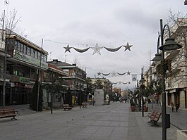
 View of Majadahonda | |
| Coordinates: 40°28′21.9″N 3°52′20.7″W / 40.472750°N 3.872417°W | |
| Country | |
| Community | |
| Province | |
| Government | |
| • Mayor | María Dolores Moreno |
| Area | |
| • Total | 38.47 km2 (14.85 sq mi) |
| Population (January 1, 2021) | |
| • Total | 72,173 |
| • Density | 1,876/km2 (4,860/sq mi) |
| Time zone | UTC+01:00 (CET) |
| Postal code | 28220–28222 |
| MCN | 28080 |
| Website | Official website |
Majadahonda is a municipality in the Community of Madrid, Spain.
It has an area of 38.47 km² and a population of 72,173 people.


