Manatuto Municipality
Manatuto
Manatutu | |
|---|---|
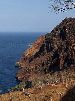
 Cliffs at Manatuto | |
 Map of East Timor highlighting Manatuto Municipality | |
| Coordinates: 8°42′S 125°55′E / 8.700°S 125.917°E | |
| Country | |
| Capital | Manatuto |
| Area | |
| • Total | 1,783.34 km2 (688.55 sq mi) |
| Population (2015) | |
| • Total | 46,619 |
| • Density | 26/km2 (68/sq mi) |
| ISO 3166 code | TL-MT |
Manatuto is one of the municipalities (formerly districts) of East Timor. The capital of the municipality is also named Manatuto.
To the north is the Strait of Wetar, to the south is the Timor Sea.
Administrative posts[change | change source]
The municipality's administrative posts (formerly sub-districts) are:[1][2]
- Barique-Natarbora (pop. 5,438)
- Laclo (pop. 7,756)
- Laclubar (pop. 12,050)
- Laleia (pop. 3,689)
- Manatuto (pop. 14,392)
- Soibada (pop. 3,294)
The administrative posts are divided into 31 sucos ("villages") in total.
References[change | change source]
- ↑ "Manatuto Suco Reports". Timor-Leste Ministry of Finance.
- ↑ Gunn, Geoffrey C (2011). Historical Dictionary of East Timor. Lanham, Maryland: Scarecrow Press. p. 124. ISBN 9780810867543.

