Maumee River
| Maumee River | |
|---|---|
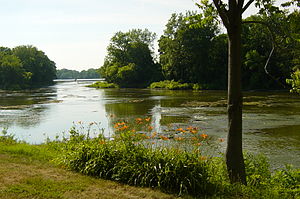
 The Maumee River at Grand Rapids, Ohio | |
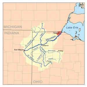
 Map of the Maumee River watershed | |
| Location | |
| Country | United States |
| States | Indiana, Ohio |
| Cities and towns | Fort Wayne, Indiana; New Haven, Indiana; Antwerp, Ohio; Cecil, Ohio; Defiance, Ohio; Florida, Ohio; Napoleon, Ohio; Grand Rapids, Ohio; Waterville, Ohio; Maumee, Ohio; Perrysburg, Ohio; Rossford, Ohio; Toledo, Ohio; Oregon, Ohio |
| Physical characteristics | |
| Source | |
| - location | Fort Wayne by the confluence of the St. Joseph and St. Marys |
| - coordinates | 41°04′58″N 85°07′56″W / 41.0827778°N 85.1322222°W |
| - elevation | 750 ft (230 m) |
| Mouth | |
| - location | Lake Erie at Toledo |
| - coordinates | 41°41′58″N 83°27′36″W / 41.6994444°N 83.46°W |
| - elevation | 571 ft (174 m) |
| Length | 137 miles (220 km) |
| Basin size | 6,354 sq mi (16,460 km2) |
| Discharge | |
| - average | 5,297 cu ft/s (150.0 m3/s) |
| Basin features | |
| Progression | Northeast |
The Maumee River (pronounced /mɔːˈmiː/)[1] (Shawnee: Hotaawathiipi;[2] Miami-Illinois: Taawaawa siipiiwi)[3] is a river running from northeastern Indiana into northwestern Ohio and Lake Erie in the United States. The city of Toledo is located at the mouth of the Maumee.
It is the largest watershed of any of the rivers feeding the Great Lakes, and supplies five percent of Lake Erie’s water.
References[change | change source]
- ↑ "Maumee – Definition and More from the Free Merriam-Webster Dictionary". Merriam-webster.com. Retrieved November 1, 2012.
- ↑ "Shawnees Webpage". Shawnee's Reservation. 1997. Archived from the original on 2013-06-30. Retrieved 2013-04-26.
- ↑ "Myaamiaatawaakani | Myaamia Dictionary". Archived from the original on 2017-08-30. Retrieved 2019-07-25.
