Millbrook, New York
Millbrook, New York | |
|---|---|
 Franklin Ave | |
| Etymology: From local estate | |
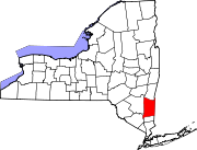
 Location of Millbrook, New York | |
 Location of New York in the United States | |
| Coordinates: 41°47′5″N 73°41′16″W / 41.78472°N 73.68778°W | |
| Country | United States |
| State | New York |
| County | Dutchess |
| Town | Washington |
| Founded | 1895 |
| Area | |
| • Total | 1.92 sq mi (4.96 km2) |
| • Land | 1.86 sq mi (4.82 km2) |
| • Water | 0.06 sq mi (0.14 km2) |
| Elevation | 480 ft (150 m) |
| Highest elevation | 870 ft (270 m) |
| Lowest elevation | 450 ft (140 m) |
| Population | |
| • Total | 1,455 |
| • Density | 782.26/sq mi (302.08/km2) |
| Time zone | UTC-5 (Eastern (EST)) |
| • Summer (DST) | UTC-4 (EDT) |
| ZIP Code | 12545 |
| Area code | 845 |
| FIPS code | 36-47273 |
| GNIS feature ID | 0957288 |
| Website | Village website |
Millbrook is a village in Dutchess County, New York, United States. Millbrook is located in the Hudson Valley, on the east side of the Hudson River, 90 miles (140 km) north of New York City. Millbrook is near the center of the Town of Washington. As of the 2020 Census, Millbrook's population was 1,455.[2] It is often referred to as a low-key version of the Hamptons and is one of the most affluent villages in New York.[source?]
Millbrook is part of the Poughkeepsie–Newburgh–Middletown Metropolitan Statistical Area as well as the larger New York–Newark–Bridgeport Combined Statistical Area.
Geography[change | change source]
According to the United States Census Bureau, the village has a total area of 1.92 square miles (4.96 km2), of which 1.86 square miles (4.82 km2) is land and 0.055 square miles (0.14 km2) (2.9%) is water.
References[change | change source]
- ↑ "ArcGIS REST Services Directory". United States Census Bureau. Retrieved September 20, 2022.
- ↑ 2.0 2.1 "Profile of General Population and Housing Characteristics: 2020 Demographic Profile Data (DP-1): Millbrook village, New York". United States Census Bureau. Retrieved March 11, 2024.

