
Montezuma, Kansas
Montezuma, Kansas | |
|---|---|
 Location within Gray County and Kansas | |
 | |
| Coordinates: 37°35′33″N 100°27′00″W / 37.59250°N 100.45000°W[1] | |
| Country | United States |
| State | Kansas |
| County | Gray |
| Founded | 1879 |
| Incorporated | 1917 |
| Named for | Moctezuma II |
| Area | |
| • Total | 1.02 sq mi (2.63 km2) |
| • Land | 1.02 sq mi (2.63 km2) |
| • Water | 0.00 sq mi (0.00 km2) |
| Elevation | 2,779 ft (847 m) |
| Population | |
| • Total | 975 |
| • Density | 960/sq mi (370/km2) |
| Time zone | UTC-6 (CST) |
| • Summer (DST) | UTC-5 (CDT) |
| ZIP code | 67867 |
| Area code | 620 |
| FIPS code | 20-47875 |
| GNIS ID | 2395379[1] |
Montezuma is a city in Gray County, Kansas, United States. As of the 2020 census, 975 people lived there.[3]
History[change | change source]
Montezuma was founded in 1879, and relocated in 1912 to the Santa Fe Railroad.[4] It was named after Moctezuma II, ruler of the Aztec Empire.[5]
Geography[change | change source]
Montezuma is at 37°35′43″N 100°26′32″W / 37.595353°N 100.442205°W (37.595353, -100.442205).[6]
According to the United States Census Bureau says that the city has a total area of 1.02 square miles (2.63 km2). All of it is land.[2]
Climate[change | change source]
According to the Köppen Climate Classification system says that Montezuma has a semi-arid climate, abbreviated "BSk" on climate maps.[7]
People[change | change source]
| Historical population | |||
|---|---|---|---|
| Census | Pop. | %± | |
| 1920 | 163 | — | |
| 1930 | 424 | 160.1% | |
| 1940 | 340 | −19.8% | |
| 1950 | 509 | 49.7% | |
| 1960 | 543 | 6.7% | |
| 1970 | 606 | 11.6% | |
| 1980 | 730 | 20.5% | |
| 1990 | 838 | 14.8% | |
| 2000 | 966 | 15.3% | |
| 2010 | 966 | 0.0% | |
| 2020 | 975 | 0.9% | |
| U.S. Decennial Census | |||
2020 census[change | change source]
The 2020 census says that there were 975 people, 400 households, and 246 families living in Montezuma. Of the households, 67.5% owned their home and 32.5% rented their home.
The median age was 43.0 years. Of the people, 89.9% were White, 3.1% were from some other race, and 7.0% were two or more races. Hispanic or Latino of any race were 10.9% of the people.[3][8]
2010 census[change | change source]
The 2010 census says that there were 966 people, 366 households, and 249 families living in the city.[9]
Education[change | change source]
Montezuma is a part of USD 371 South Gray Schools. USD 371 and USD 476 share South Gray High School. The South Gray High School mascot is South Gray Rebels.[10]
Before to school unification, the Montezuma High School mascot was Montezuma Indians.[11] The Montezuma Indians won the Kansas State High School boys class BB basketball championship in 1955.[12]
References[change | change source]
- ↑ 1.0 1.1 1.2 U.S. Geological Survey Geographic Names Information System: Montezuma, Kansas
- ↑ 2.0 2.1 "2020 U.S. Gazetteer Files". United States Census Bureau. Retrieved December 12, 2023.
- ↑ 3.0 3.1 3.2 "DP1: PROFILE OF GENERAL POPULATION AND HOUSING CHARACTERISTICS". United States Census Bureau. Retrieved December 12, 2023.
- ↑ Kansas State Historical Society (1916). Biennial Report of the Board of Directors of the Kansas State Historical Society. Kansas State Printing Plant. p. 198.
- ↑ "Profile for Montezuma, Kansas". ePodunk. Archived from the original on 14 July 2014. Retrieved 10 June 2014.
- ↑ "US Gazetteer files: 2010, 2000, and 1990". United States Census Bureau. 2011-02-12. Retrieved 2011-04-23.
- ↑ Climate Summary for Montezuma, Kansas
- ↑ "P16: HOUSEHOLD TYPE". United States Census Bureau. Retrieved January 2, 2024.
- ↑ "American FactFinder". United States Census Bureau. Retrieved 2012-07-06.
- ↑ "South Gray Schools". USD 371. Retrieved 4 January 2017.
- ↑ "Montezuma Indians Pace Santa Fe Trail Conference", Garden City Telegram, 26 December 1959, p.5.
- ↑ "Basketball". KSHSAA. Archived from the original on 2 January 2017. Retrieved 3 January 2017.
Other websites[change | change source]
- City
- Schools
- USD 371, local school district
- Maps
- Montezuma City Map, KDOT
Municipalities and communities of Gray County, Kansas, United States | ||
|---|---|---|
| Cities | 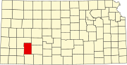 | |
| Unincorporated communities | ||
| Townships | ||