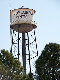
Mosquero, New Mexico
Mosquero, New Mexico | |
|---|---|
 | |
 Location of Mosquero, New Mexico | |
| Coordinates: 35°46′35″N 103°57′26″W / 35.77639°N 103.95722°W | |
| Country | United States |
| State | New Mexico |
| Counties | Harding, San Miguel |
| Area | |
| • Total | 1.00 sq mi (2.58 km2) |
| • Land | 1.00 sq mi (2.58 km2) |
| • Water | 0.00 sq mi (0.00 km2) |
| Elevation | 5,591 ft (1,704 m) |
| Population | |
| • Total | 98 |
| • Density | 98.20/sq mi (37.92/km2) |
| Time zone | UTC-7 (Mountain (MST)) |
| • Summer (DST) | UTC-6 (MDT) |
| ZIP code | 87733 |
| Area code | 575 |
| FIPS code | 35-50300 |
| GNIS feature ID | 0892254 |
| Website | www |
Mosquero is a village in Harding and San Miguel counties in the U.S. state of New Mexico. The population was 98 at the 2020 census.[2]
References[change | change source]
- ↑ "ArcGIS REST Services Directory". United States Census Bureau. Retrieved October 12, 2022.
- ↑ 2.0 2.1 "Profile of General Population and Housing Characteristics: 2020 Demographic Profile Data (DP-1): Mosquero village, New Mexico". United States Census Bureau. Retrieved March 14, 2024.

