Mount Chōkai
| Mount Chōkai | |
|---|---|
| 鳥海山 | |
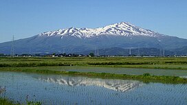
 As seen from the southwest | |
| Highest point | |
| Elevation | 2,236 m (7,336 ft)[1] |
| Prominence | 1,891 m (6,204 ft)[1] |
| Listing | •100 famous mountains in Japan •Ultra |
| Coordinates | 39°05′57″N 140°02′56″E / 39.09917°N 140.04889°E[1] |
| Geography | |
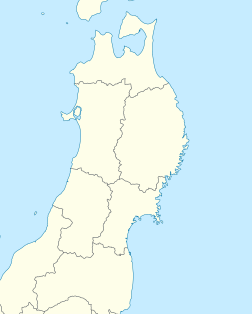
| Location | Yamagata and Akita, Tōhoku, Japan |
| Geology | |
| Mountain type | Stratovolcano |
| Last eruption | March to April 1974 |
Mount Chōkai (鳥海山, Chōkai-san or Chōkai-zan) is a large volcano located in the Tōhoku region of Japan. It is on the border of Akita and Yamagata and is 2,236 meters tall. Because of its size and shape, it is sometimes called Dewa Fuji, Akita Fuji, or Shōnai Fuji[2] It is considered one of the 100 Famous Landscapes of Japan and one of the 100 famous mountains in Japan. It is also surrounded by the Chōkai Quasi-National Park and is a National Historic Site of Japan,[3] Many people consider it a sacred mountain and enjoy hiking there.
Related pages[change | change source]
References[change | change source]
- ↑ 1.0 1.1 1.2 "Japan Ultra-Prominences". Peaklist.org. Retrieved 2015-01-01.
- ↑ "鳥海山登山ガイド". Mt. Chokai WEB. Retrieved 13 January 2014.
- ↑ Mount Chōkai&Tobishima Geopark

