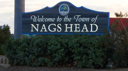
Nags Head, North Carolina
Nags Head, North Carolina | |
|---|---|
 | |
 Location in Dare County and the U.S. state of North Carolina | |
| Coordinates: 35°55′55″N 75°36′54″W / 35.93194°N 75.61500°W | |
| Country | United States |
| State | North Carolina |
| County | Dare |
| Incorporated | 1923 and 1961[1] |
| Named for | Tied lanterns around the necks of ponies[1] |
| Area | |
| • Total | 6.68 sq mi (17.31 km2) |
| • Land | 6.62 sq mi (17.14 km2) |
| • Water | 0.07 sq mi (0.17 km2) |
| Elevation | 3 ft (1 m) |
| Population | |
| • Total | 3,168 |
| • Density | 478.69/sq mi (184.84/km2) |
| Time zone | UTC-5 (Eastern (EST)) |
| • Summer (DST) | UTC-4 (EDT) |
| ZIP Code | 27959 |
| Area code | 252 |
| FIPS code | 37-45880[4] |
| GNIS feature ID | 1021599[5] |
| Website | nagsheadnc |
Nags Head is a town in Dare County, North Carolina, United States. The population was 3,168 at the 2020 census.[3]
References[change | change source]
- ↑ 1.0 1.1 "North Carolina Gazetteer". Retrieved March 27, 2021.
- ↑ "ArcGIS REST Services Directory". United States Census Bureau. Retrieved September 20, 2022.
- ↑ 3.0 3.1 "Profile of General Population and Housing Characteristics: 2020 Demographic Profile Data (DP-1): Nags Head town, North Carolina". United States Census Bureau. Retrieved February 26, 2024.
- ↑ "U.S. Census website". United States Census Bureau. Retrieved 2008-01-31.
- ↑ "US Board on Geographic Names". United States Geological Survey. 2007-10-25. Retrieved 2008-01-31.
Other websites[change | change source]
- Official website of Nags Head, NC
- Web cam of Nags Head, NC – East Archived 2016-04-01 at the Wayback Machine
- Web cam of Nags Head, NC – West Archived 2016-04-02 at the Wayback Machine
- Nags Head MLS
Wikimedia Commons has media related to Nags Head, North Carolina.


