Nambal, Khyber Pakhtunkhwa
Nambal | |
|---|---|
 Nambal is in Abbottabad District | |
| Coordinates: 34°N 73°E / 34°N 73°E | |
| Country | |
| Province | Khyber Pakhtunkhwa |
| District | Abbottabad |
| Tehsil | Abbottabad |
| Government | |
| • Nazim | Sardar Muhammad Gulzar[1] |
| • Naib Nazim | Malik Liaqat Hussain |
| Population | |
| • Total | 8,900 |
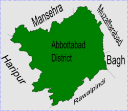
Nambal is one of the 51 Union Councils of Abbottabad district in the Khyber Pakhtunkhwa province of Pakistan.
Location[change | change source]
Nambal is a mountainous area in the east of the district bordering Kashmir, where it has trade and tribal links. The Union Council takes its name from the main village of the area - i.e. Nambal.
There are also famous villages called Leeran,Bribagla, Mujot, Langaloot, Nakthar,Mujhot,etc. at the top of a mountain with a view of Azad Kashmir, Murree and Thandiani. Because of the mountains this small valley is very difficult to get to.
Climate[change | change source]
The valley is full of Bhayar trees.and at the top of these villages a beautiful view of TOPA, there is beautiful forest of Bhayar tree. As these village are on a mountain it receives 3–4 feet of snow during winter. Winters are extremely cold while summers are very pleasant.
Subdivisions[change | change source]
The Union Council is divided into two areas Majuhan and Nambal[1] - as part of the local government reforms of 2000 Majuhan was merged into Nambal Union Council.
