Needham, Massachusetts
Needham, Massachusetts | |
|---|---|
 Town Hall | |
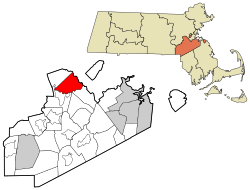
 Location in Norfolk County in Massachusetts | |
| Coordinates: 42°17′00″N 71°14′00″W / 42.28333°N 71.23333°W | |
| Country | |
| State | |
| County | |
| Settled | 1680 |
| Incorporated | 1711 |
| Named for | Needham Market |
| Area | |
| • Total | 32.9 km2 (12.7 sq mi) |
| • Land | 31.9 km2 (12.3 sq mi) |
| • Water | 1.1 km2 (0.4 sq mi) |
| Elevation | 49 m (162 ft) |
| Population | |
| • Total | 32,091 |
| • Density | 1,007.5/km2 (2,609.4/sq mi) |
| Time zone | UTC−5 (Eastern) |
| • Summer (DST) | UTC−4 (Eastern) |
| ZIP Code | 02492 and 02494 |
| Area code | 781 |
| FIPS code | 25-44105 |
| GNIS feature ID | 0618325 |
| Website | www.needhamma.gov |
Needham is a town in Norfolk County, Massachusetts, United States. It is a suburb of Boston. Its population was 32,091 in 2020.[2] It is home to the Olin College, an engineering school.
In 2005, Needham became the first city in the United States to raise the age to legally buy tobacco products to 21.[3]
According to the United States Census Bureau, the town has a total area of 12.7 square miles (32.9 km²), of which 12.3 square miles (31.9 km²) is land and 0.4 square miles (1.1 km²) is water.
References[change | change source]
- ↑ "2020 U.S. Gazetteer Files". United States Census Bureau. Retrieved March 4, 2024.
- ↑ 2.0 2.1 "QuickFacts: Needham town, Norfolk County, Massachusetts". United States Census Bureau. Retrieved March 4, 2024.
- ↑ Quinn, Colleen (December 26, 2013). "Nearly a dozen Massachusetts towns raise age for cigarette sales". Boston.com. The Boston Globe. State House News Service. Retrieved 4 September 2014.


