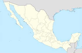
Pabellón de Arteaga Municipality
Pabellón de Arteaga | |
|---|---|
 Municipality location in Aguascalientes | |
| Coordinates: 22°09′N 102°16′W / 22.150°N 102.267°W | |
| Country | Mexico |
| State | Aguascalientes |
| Municipal seat | Pabellón de Arteaga |
| Area | |
| • Total | 199.72 km2 (77.11 sq mi) |
| Population (2015) | |
| • Total | 46,473 |
| • Density | 230/km2 (600/sq mi) |
Pabellón de Arteaga is a municipality of 11 municipalities in the Mexican state of Aguascalientes and located in the central part of it, its capital is the city of Pabellón de Arteaga with a population of 47,646 inhabitants in 2020.
| Year | Pop. | ±% |
|---|---|---|
| 2010 | 41,862 | — |
| 2015 | 46,473 | +11.0% |
| 2020 | 47,646 | +2.5% |
| [1][2][3][4] | ||
References[change | change source]
- ↑ "Localidades y su población por municipio según tamaño de localidad" (PDF) (in Spanish). INEGI. Archived from the original (PDF) on August 31, 2018. Retrieved July 15, 2017.
- ↑ "Número de habitantes". INEGI (National Institute of Statistics and Geography). Archived from the original on July 2, 2017. Retrieved July 15, 2017.
- ↑ "Tabulados de la Encuesta Intercensal 2015" (xls) (in Spanish). INEGI. Archived from the original on December 31, 2017. Retrieved July 15, 2017.
- ↑ "INEGI. Censo de Población y Vivienda 2020. Tabulados del Cuestionario Básico – Aguascalientes" [INEGI. 2020 Population and Housing Census. Basic Questionnaire Tabulations – Aguascalientes] (Excel) (in Spanish). INEGI. 2020. pp. 1–4. Archived from the original on January 28, 2021. Retrieved January 27, 2021.
Other websites[change | change source]
- Ayuntamiento de Pabellón de Arteaga Archived 2022-01-24 at the Wayback Machine Official website
- Aguascalientes state government (in Spanish)


