
Plains, Kansas
Plains, Kansas | |
|---|---|
 Location within Meade County and Kansas | |
 | |
| Coordinates: 37°15′51″N 100°35′23″W / 37.26417°N 100.58972°W[1] | |
| Country | United States |
| State | Kansas |
| County | Meade |
| Founded | 1800s |
| Platted | 1885 |
| Incorporated | 1908 |
| Area | |
| • Total | 1.00 sq mi (2.59 km2) |
| • Land | 1.00 sq mi (2.59 km2) |
| • Water | 0.00 sq mi (0.00 km2) |
| Elevation | 2,759 ft (841 m) |
| Population | |
| • Total | 1,037 |
| • Density | 1,000/sq mi (400/km2) |
| Time zone | UTC-6 (CST) |
| • Summer (DST) | UTC-5 (CDT) |
| ZIP code | 67869 |
| Area code | 620 |
| FIPS code | 20-56100 |
| GNIS ID | 2396219[1] |
Plains is a city in Meade County, Kansas, United States. In 2020, 1,037 people lived there.[3] Its main street is the widest in the United States; the street is 155 feet 5 inches (47.37 m) wide.[4]
History[change | change source]
.jpg)
Plains was first called West Plains,[5] and it was platted as West Plains in January 1885.[6]
Geography[change | change source]
The United States Census Bureau says that the city has a total area of 1.00 square mile (2.59 km2). All of it is land.[2]
Climate[change | change source]
The Köppen Climate Classification system says that Plains has a semi-arid climate, shortened to "BSk" on climate maps.[7]
People[change | change source]
| Historical population | |||
|---|---|---|---|
| Census | Pop. | %± | |
| 1890 | 62 | — | |
| 1910 | 333 | — | |
| 1920 | 361 | 8.4% | |
| 1930 | 383 | 6.1% | |
| 1940 | 619 | 61.6% | |
| 1950 | 718 | 16.0% | |
| 1960 | 780 | 8.6% | |
| 1970 | 857 | 9.9% | |
| 1980 | 1,044 | 21.8% | |
| 1990 | 957 | −8.3% | |
| 2000 | 1,163 | 21.5% | |
| 2010 | 1,146 | −1.5% | |
| 2020 | 1,037 | −9.5% | |
| U.S. Decennial Census | |||
2020 census[change | change source]
In 2020, there were 1,037 people, 367 households, and 268 families living in Plains. The population density was 1,038.0 inhabitants per square mile (400.8/km2). 65.0% of the people were White, 0.1% were African American, 17.6% were from other races, and 17.3% were from two or more races. 43.0% of the people were Hispanic or Latino of any race.[3][8]
2010 census[change | change source]
In 2010, there were 1,146 people, 385 households and 310 families living in Plains. The population density was 1,146.0 inhabitants per square mile (442.5/km2). 88.1% of the people were White, 0.3% were African American, 1.0% were Native American, 0.4% were Asian, 8.5% were from other races, and 1.7% were from two or more races. 36.0% of the people were Hispanic or Latino of any race.[9]
2000 census[change | change source]
In 2000, there were 1,163 people, 402 households and 303 families living in Plains. The population density was 1,175.8 per square mile (453.6/km²). 82.12% of the people were White, 1.29% were Native American, 14.27% were from other races, and 2.32% were from two or more races. 26.23% of the people were Hispanic or Latino of any race.[10]
Education[change | change source]
Plains is a part of USD 483 Southwestern Heights. The district high school, Southwestern Heights, is between Kismet and Plains. The Southwestern Heights High School mascot is Southwestern Heights Mustangs.[11]
References[change | change source]
- ↑ 1.0 1.1 1.2 U.S. Geological Survey Geographic Names Information System: Plains, Kansas
- ↑ 2.0 2.1 "2020 U.S. Gazetteer Files". United States Census Bureau. Retrieved November 30, 2023.
- ↑ 3.0 3.1 3.2 "DP1: PROFILE OF GENERAL POPULATION AND HOUSING CHARACTERISTICS". United States Census Bureau. Retrieved November 30, 2023.
- ↑ "Plains, Kansas... Widest Main Street in the USA". Meade Economic Development Committee. Archived from the original on 8 August 2014. Retrieved 31 July 2014.
- ↑ Kansas State Historical Society (1916). Biennial Report of the Board of Directors of the Kansas State Historical Society. Kansas State Printing Plant. pp. 239.
- ↑ Sullivan, Frank Seymour (1916). A History of Meade County, Kansas. Crane & Company. pp. 34.
- ↑ Climate Summary for Plains, Kansas
- ↑ "P16: HOUSEHOLD TYPE". United States Census Bureau. Retrieved January 2, 2024.
- ↑ "American FactFinder". United States Census Bureau. Retrieved 6 July 2012.
- ↑ "American FactFinder". United States Census Bureau. Retrieved 2008-01-31.
- ↑ "Southwestern Heights - USD 483". USD 483. Retrieved 5 January 2017.
Other websites[change | change source]
- City
- Plains - Directory of Public Officials
- Plains Economic Development Archived 2020-05-13 at the Wayback Machine
- Schools
- USD 483, local school district
- Historical
- Photos of early Plains Archived 2020-04-07 at the Wayback Machine
- Maps
- Plains City Map, KDOT
Municipalities and communities of Meade County, Kansas, United States | ||
|---|---|---|
| Cities | 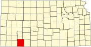 | |
| Unincorporated community | ||