
Pontotoc County, Mississippi
Pontotoc County | |
|---|---|
 Pontotoc County Courthouse in Pontotoc | |
 Flag | |
 Location within the U.S. state of Mississippi | |
 Mississippi's location within the U.S. | |
| Coordinates: 34°14′N 89°02′W / 34.23°N 89.04°W | |
| Country | |
| State | |
| Founded | 1836 |
| Named for | Chickasaw word for the region meaning either "cattail prairie" "land of hanging grapes" |
| Seat | Pontotoc |
| Largest city | Pontotoc |
| Area | |
| • Total | 501 sq mi (1,300 km2) |
| • Land | 498 sq mi (1,290 km2) |
| • Water | 3.3 sq mi (9 km2) 0.7% |
| Population (2020) | |
| • Total | 31,184 |
| • Density | 62/sq mi (24/km2) |
| Time zone | UTC−6 (Central) |
| • Summer (DST) | UTC−5 (CDT) |
| Congressional district | 1st |
| Website | pontotoccoms |
Pontotoc County is a county in the U.S. state of Mississippi. As of the 2020 census, 31,184 people lived there.[1] Its county seat is Pontotoc.[2]
References[change | change source]
- ↑ "QuickFacts: Pontotoc County, Mississippi". United States Census Bureau. Retrieved January 4, 2024.
- ↑ "Find a County". National Association of Counties. Retrieved 2011-06-07.
Other websites[change | change source]
Wikimedia Commons has media related to Pontotoc County, Mississippi.
- Official county website Archived 2018-06-06 at the Wayback Machine
Municipalities and communities of Pontotoc County, Mississippi, United States | ||
|---|---|---|
| City | 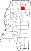 | |
| Towns | ||
| CDP | ||
| Other communities | ||
| Footnotes | ‡This populated place also has portions in an adjacent county or counties | |