Punggol
1°23′53.8″N 103°54′32.3″E / 1.398278°N 103.908972°E
Punggol | |
|---|---|
| Other transcription(s) | |
| • Chinese | 榜鹅 |
| • Pinyin | Bǎng'é |
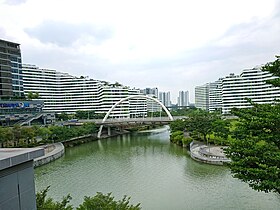
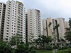
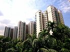
From top left to right: Punggol Town Centre, Flats at Edgedale Plains, Flats at Punggol Cove, Panoramic view of Greendale Secondary School, Watertown, Punggol Plaza, Punggol Waterway Park | |
| Country | |
| Region | North-East Region
|
| CDC | |
| Town council |
|
| Constituency | |
| Government | |
| • Mayor | North East CDC
|
| • Members of Parliament | Pasir Ris-Punggol GRC |
| Area | |
| • Total | 9.57 km2 (3.69 sq mi) |
| • Residential | 3.74 km2 (1.44 sq mi) |
| Population | |
| • Total | 161,570 |
| • Density | 17,000/km2 (44,000/sq mi) |
| Demonyms | Official
Colloquial
|
| Postal district | 19 |
| Dwelling units | 43,385 |
| Projected ultimate | 96,000 |
Punggol (in Chinese: 榜鹅, in Tamil: பொங்கோல்), which can also be spelt as Ponggol, is a planning area and town. It was built on the Tanjong Pungool peninsula in the North-Eastern part of Singapore. It is North of Sengkang and has a riverline border with Seletar and Pasir Ris. The Straits of Johor is North of it. Coney Island is part of Pungool.[4][5]
References[change | change source]
- ↑ 1.0 1.1 "Punggol (Planning Area, Singapore) - Population Statistics, Charts, Map and Location". www.citypopulation.de.
- ↑ 2.0 2.1 "Land Area and Dwelling Units by Town". Data Singapore. 2016. Archived from the original on June 12, 2019. Retrieved January 26, 2018.
- ↑ "Statistics Singapore - Geographic Distribution - 2018 Latest Data". Retrieved February 11, 2019.
- ↑ "Punggol (Planning Area, Singapore) - Population Statistics, Charts, Map and Location". www.citypopulation.de. Retrieved 2019-07-26.
- ↑ "Punggol: Waves of Recreation". www.roots.sg. Archived from the original on 2019-07-26. Retrieved 2019-07-26.


