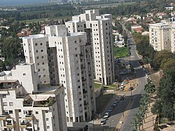
Ramat HaSharon
Ramat HaSharon
רמת השרון رمات هشارون | |
|---|---|
| Hebrew transcription(s) | |
| • ISO 259 | Ramat ha Šaron |
 Central City of Ramat HaSharon | |
| Coordinates: 32°09′N 34°50′E / 32.150°N 34.833°E | |
| Country | |
| District | |
| Founded | 1923 |
| Government | |
| • Mayor | Avi Gruber |
| Area | |
| • Total | 16,792 dunams (16.792 km2 or 6.483 sq mi) |
| Population (2017)[1] | |
| • Total | 46,019 |
| • Density | 2,700/km2 (7,100/sq mi) |
| Name meaning | Sharon Height |
| Website | ramat-hasharon.muni.il |
Ramat HaSharon (Hebrew: רָמַת הַשָּׁרוֹן, lit. Sharon Heights or Heights of the (Great) Plain, Arabic: رمات هشارون)[2][3][4][5] is a city on Israel's central coastal section in the south of the Sharon region.
References[change | change source]
- ↑ "List of localities, in Alphabetical order" (PDF). Israel Central Bureau of Statistics. Retrieved August 26, 2018.
- ↑ "Ramat HaSharon | Buildings | EMPORIS". www.emporis.com.
- ↑ "The amazing name Sharon: meaning and etymology". Abarim Publications.
- ↑ "Sharon Definition and Meaning - Bible Dictionary". biblestudytools.com.
- ↑ "رمات هشارون مدينة سلام". Israeli Foreign Ministry Website.


