Roma, Gotland
Romakloster | |
|---|---|
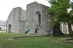
 Roma Abbey church ruins | |
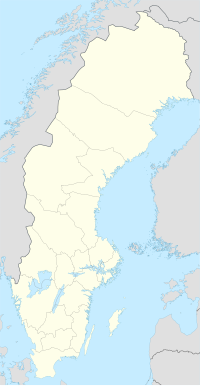
| Coordinates: 57°30′19.7″N 18°27′14.6″E / 57.505472°N 18.454056°E | |
| Country | Sweden |
| Province | Gotland |
| County | Gotland County |
| Municipality | Gotland Municipality |
| Area | |
| • Total | 1.26 km2 (0.49 sq mi) |
| Population (31 December 2010)[1] | |
| • Total | 913 |
| • Density | 727/km2 (1,880/sq mi) |
| Time zone | UTC+1 (CET) |
| • Summer (DST) | UTC+2 (CEST) |

Roma (also referred to as Romakloster) is a locality (Swedish tätort) in Gotland Municipality, Gotland County, Sweden. In 2010, 913 people lived there.[2]
In 1995 the locality known as Roma was divided by Statistics Sweden into a part with the tentative name of "Roma kyrkby" or "Lövsta" (pop. 277) and the remaining part that retained the name "Roma" (pop. 913), but is using to as "Romakloster" as postal address.[3] Some confusion is caused by the fact that Lövsta/Roma kyrkby has been referred to as "Roma" in the statistical figures since 2000.[4]
References[change | change source]
- ↑ 1.0 1.1 "Tätorternas landareal, folkmängd och invånare per km2 2005 och 2010" (in Swedish). Statistics Sweden. 14 December 2011. Archived from the original on 10 January 2012. Retrieved 10 January 2012.
- ↑ "Tätorternas landareal, folkmängd och invånare per km2 2005 och 2010" (in Swedish). Statistics Sweden. 14 December 2011. Archived from the original on 10 January 2012. Retrieved 10 January 2012.
- ↑ Tätorter 1995, p. 30 (population; see footnote for the tentative character of the names), 62 (list of new localities since 1990)
- ↑ Cf. the population figures from 1995 for Roma kyrkby/Roma (277 people) and Romakloster (902) given in Tätorter 1995, p. 30, and Tätorter 2000, p. 27.
Other websites[change | change source]
![]() Media related to Roma, Gotland at Wikimedia Commons
Media related to Roma, Gotland at Wikimedia Commons

