Saint Mary-of-the-Woods, Indiana
Saint Mary-of-the-Woods | |
|---|---|
| Nickname(s): Saint Mary's, the Woods | |
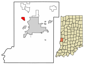
 Location of St. Mary of the Woods in Vigo County, Indiana. | |
| Coordinates: 39°30′39″N 87°28′02″W / 39.51083°N 87.46722°W | |
| Country | United States |
| State | Indiana |
| County | Vigo |
| Township | Sugar Creek |
| Area | |
| • Total | 1.26 sq mi (3.26 km2) |
| • Land | 1.24 sq mi (3.21 km2) |
| • Water | 0.02 sq mi (0.05 km2) |
| Elevation | 558 ft (170 m) |
| Population (2020) | |
| • Total | 767 |
| • Density | 619.05/sq mi (238.96/km2) |
| Time zone | UTC-5 (Eastern (EST)) |
| • Summer (DST) | UTC-4 (EDT) |
| ZIP code | 47876 |
| Area code(s) | 812, 930 |
| GNIS feature ID | 442687 |
Saint Mary-of-the-Woods, often called St. Mary's, is an unincorporated community in Sugar Creek Township in northwestern Vigo County, in the U.S. state of Indiana.[3] It had a population of 767 at the 2020 census.
References[change | change source]
- ↑ "2020 U.S. Gazetteer Files". United States Census Bureau. Retrieved March 16, 2022.
- ↑ "US Board on Geographic Names". United States Geological Survey. October 25, 2007. Retrieved 2016-07-13.
- ↑ [[[:Template:GNIS3]] "Saint Mary-of-the-Woods, Indiana"]. Geographic Names Information System. United States Geological Survey. Retrieved August 6, 2017.
{{cite web}}: Check|url=value (help)
