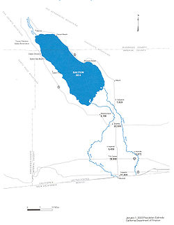
Salton Sea

The Salton Sea is a large inland lake in the United States state of California. There are no rivers which flow out of it (making it an endorheic lake), making it an extremely saline lake. It is approximately 35 miles (56 km) long from north to south, and 15 miles (24 km) wide from east to west. It is well below sea level, with its surface elevation at −226 feet (−69 m), and its deepest part is 52 feet (16 m) deep. The New River and Alamo River flow in from the south, while the Whitewater River flows in from the north. It was created in 1905, when heavy rain flooded the Colorado River and caused it to flow into the basin that now holds the Salton Sea.[1]
References[change | change source]
- ↑ "The Salton Sea, CA - DesertUSA". www.desertusa.com. Retrieved 2022-03-07.


