
San José Province
Province of San José
Provincia de San José | |
|---|---|
.jpg) National theatre, San José | |
 Flag  Coat of arms | |
 Location of the Province of San José | |
| Coordinates: 9°56′N 84°05′W / 9.933°N 84.083°W | |
| Country | Costa Rica |
| Capital city | San José |
| Area | |
| • Total | 4,965.90 km2 (1,917.34 sq mi) |
| Population (2011)[2] | |
| • Total | 1,404,242 |
| • Density | 280/km2 (730/sq mi) |
| Demonym | Josefino |
| ISO 3166 code | CR-SJ |
San José is a province of Costa Rica. It is in the central part of the country. The provincial capital, and the national capital since 1823, is the city of San José.
Location[change | change source]
The San José province borders with the Alajuela and Heredia provinces to the north, with the Cartago and Limón provinces to the east; and the Puntarenas to the south and the west.[1]
Places next to San José Province | ||||||||||
|---|---|---|---|---|---|---|---|---|---|---|
| ||||||||||
Geography[change | change source]
San José is in the central part of the country. The province has an area of 4,965.90 km2 (1,917.34 sq mi).[1]
The main mountains in the province are Turrubares, Camora, Cangreja, Nara, Cerro de la Muerte, San Jerónimo and Las Vueltas.
Some of the rivers that flow through the province are Grande de Candelaria, Pirrís, Virilla, Naranjo, División, Chirripó, General y Pejibaye.[3]
Demographics[change | change source]
People from the province are known as josefinos (women:josefinas).[3]
The San José province had a population, in 2011, of 1,404,242 for a population density of 282.8 inhabitants/km2. The canton of San José, with 288,054 inhabitants, is the canton with more inhabitants.[2]
Evolution of the population in San José province[2]

Administrative divisions[change | change source]
The San José province is divided in 20 cantons, which are divided into 124 Districts.[2]
| No. | Canton | Capital | Districts[4] | Population (2011) |
Area (km²) |
Density (inh./km²) |
|---|---|---|---|---|---|---|
| 1 | San José | San José | 11 | 288,054 | 44.62 | 6,455.7 |
| 2 | Escazú | Escazú | 3 | 56,509 | 34.49 | 1,638.4 |
| 3 | Desamparados | Desamparados | 13 | 208,411 | 118.26 | 1,762.3 |
| 4 | Puriscal | Puriscal | 10 | 33,004 | 553.66 | 59.6 |
| 5 | Tarrazú | San Marcos | 3 | 16,280 | 297.5 | 54.7 |
| 6 | Aserrí | Aserrí | 7 | 57,892 | 167.10 | 346.5 |
| 7 | Mora | Ciudad Colón | 7 | 26,294 | 162.04 | 162.3 |
| 8 | Goicoechea | Guadalupe | 7 | 115,084 | 31.50 | 3,653.5 |
| 9 | Santa Ana | Santa Ana | 6 | 49,123 | 61.42 | 799.8 |
| 10 | Alajuelita | Alajuelita | 5 | 77,603 | 21.17 | 3,665.7 |
| 11 | Vásquez de Coronado | San Isidro | 5 | 60,486 | 222.20 | 272.2 |
| 12 | Acosta | San Ignacio | 5 | 20,209 | 342.24 | 59.0 |
| 13 | Tibás | San Juan | 5 | 64,842 | 8.15 | 7,956.1 |
| 14 | Moravia | San Vicente | 3 | 56,919 | 28.62 | 1,988.8 |
| 15 | Montes de Oca | San Vicente | 4 | 49,132 | 15.16 | 3,240.9 |
| 16 | Turrubares | San Pablo | 5 | 5,512 | 415.29 | 13.3 |
| 17 | Dota | Santa María | 3 | 6,948 | 400.22 | 17.4 |
| 18 | Curridabat | Curridabat | 4 | 65,206 | 15.95 | 4,088.2 |
| 19 | Pérez Zeledón | San Isidro de El General | 12 | 134,534 | 1,905.51 | 70.6 |
| 20 | León Cortés | San Pablo | 6 | 12,200 | 120.80 | 101.0 |
| The province | 124 | 1,404,242 | 4,965.90 | 282.8 | ||
Gallery[change | change source]
-
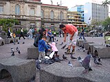 Plaza de la Cultura, San José
 -
 National Museum of Costa Rica
 -
 Okayama square


References[change | change source]
- ↑ 1.0 1.1 1.2 "Anuario Estadístico 2012 - 2013" (PDF) (in Spanish). San José, Costa Rica: Instituto Nacional de Estadística y Censos (INEC). June 2015. p. 44. Archived from the original (PDF) on 14 November 2016. Retrieved 6 February 2017.
- ↑ 2.0 2.1 2.2 2.3 "Anuario Estadístico 2012 - 2013" (PDF) (in Spanish). San José, Costa Rica: Instituto Nacional de Estadística y Censos (INEC). June 2015. p. 103. Archived from the original (PDF) on 14 November 2016. Retrieved 5 February 2017.
- ↑ 3.0 3.1 "Provincia: San José" (in Spanish). Guías Costa Rica. Retrieved 6 February 2017.
- ↑ "División Territorial Administrativa de la República de Costa Rica" (PDF) (in Spanish). San José, Costa Rica: Diario Oficial La Gaceta. 12 November 2015. Archived from the original (PDF) on 5 October 2016. Retrieved 6 February 2017.