Sottens
Sottens | |
|---|---|
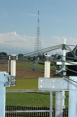
 The Sottens transmitter | |
| Coordinates: 46°39′N 6°45′E / 46.650°N 6.750°E | |
| Country | Switzerland |
| Canton | Vaud |
| District | Gros-de-Vaud |
| Area | |
| • Total | 4.53 km2 (1.75 sq mi) |
| Elevation | 755 m (2,477 ft) |
| Population (December 2009) | |
| • Total | 257 |
| • Density | 57/km2 (150/sq mi) |
| Time zone | UTC+01:00 (Central European Time) |
| • Summer (DST) | UTC+02:00 (Central European Summer Time) |
| Postal code(s) | 1062 |
| SFOS number | 5687 |
| Surrounded by | Chapelle-sur-Moudon, Hermenches, Martherenges, Montaubion-Chardonney, Moudon, Peney-le-Jorat, Peyres-Possens, Villars-Mendraz |
| Website | Profile (in French), SFSO statistics |
Sottens was a municipality in the Gros-de-Vaud district in the canton of Vaud in Switzerland. On 1 July 2011, the municipalities of Villars-Tiercelin, Montaubion-Chardonney, Sottens, Villars-Mendraz and Peney-le-Jorat joined together to become the new municipality of Jorat-Menthue.[1]
It is known for its radio transmitter for the French language Swiss radio, built in 1931.
References[change | change source]
- ↑ Amtliches Gemeindeverzeichnis der Schweiz published by the Swiss Federal Statistical Office (in German) accessed 17 February 2011
Other websites[change | change source]
![]() Media related to Sottens at Wikimedia Commons
Media related to Sottens at Wikimedia Commons


