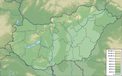
Szentes
46°39′07″N 20°15′26″E / 46.6519444544°N 20.2572222322°E
Szentes | |
|---|---|
 Near the center of the town with Lutheran Church | |
| Coordinates: 46°23′27″N 20°09′09″E / 46.3907°N 20.1526°E | |
| Country | |
| County | Csongrád |
| District | Szentes |
| Area | |
| • Total | 353.25 km2 (136.39 sq mi) |
| Population (2015) | |
| • Total | 27,898 |
| • Density | 79/km2 (200/sq mi) |
| Time zone | UTC+1 (CET) |
| • Summer (DST) | UTC+2 (CEST) |
| Postal code | 6600 |
| Area code | (+36) 63 |
| Website | www |
Szentes is a city in south-eastern Hungary, Csongrád county.
Other websites[change | change source]
- Official website in Hungarian, English, German and Serb
- Városi Visszhang - Szentes
- Local Radio Station - Radio 451 Archived 2019-12-23 at the Wayback Machine


