
Tisbury, Massachusetts
Tisbury, Massachusetts | |
|---|---|
 Vineyard Haven Harbor | |
 Flag  Seal | |
 Location in Dukes County in Massachusetts | |
| Coordinates: 41°27′22″N 70°36′40″W / 41.45611°N 70.61111°W | |
| Country | United States |
| State | Massachusetts |
| County | Dukes |
| Settled | 1660 |
| Incorporated | July 8, 1671 |
| Government | |
| • Type | Open town meeting |
| Area | |
| • Total | 19.1 sq mi (49.5 km2) |
| • Land | 6.5 sq mi (16.9 km2) |
| • Water | 12.6 sq mi (32.6 km2) |
| Elevation | 89 ft (27 m) |
| Population (2020)[2] | |
| • Total | 4,815 |
| • Density | 738/sq mi (284.9/km2) |
| Time zone | UTC-5 (Eastern) |
| • Summer (DST) | UTC-4 (Eastern) |
| ZIP code | 02568 |
| Area code | 508 / 774 |
| FIPS code | 25-69940 |
| GNIS feature ID | 0619443 |
| Website | www |
Tisbury is a town located on Martha's Vineyard in Dukes County, Massachusetts, United States. The population was 4,815 at the 2020 census.[2]
References[change | change source]
- ↑ "2020 U.S. Gazetteer Files". United States Census Bureau. Retrieved March 5, 2024.
- ↑ 2.0 2.1 "Profile of General Population and Housing Characteristics: 2020 Demographic Profile Data (DP-1): Tisbury town, Dukes County, Massachusetts". United States Census Bureau. Retrieved March 5, 2024.
Municipalities and communities of Dukes County, Massachusetts, United States | ||
|---|---|---|
| Towns | 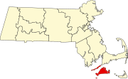 | |
| CDPs | ||
| Other villages | ||
| Indian reservation | ||