Villavicencio
Villavicencio | |
|---|---|
City | |
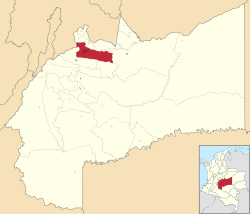
 Location map of the municipality and city of Villavicencio in the Department of Meta. | |
| Coordinates: 4°9′N 73°38′W / 4.150°N 73.633°W | |
| Country | Colombia |
| Region | Orinoquía |
| Department | Department of Meta |
| Founded | 1840 |
| Government | |
| • Mayor | Juan Guillermo Zuluaga Cardona |
| Area | |
| • Total | 1,328 km2 (513 sq mi) |
| Elevation | 467 m (1,532 ft) |
| Population (2005)[1] | |
| • Total | 384,131 |
| • Density | 290/km2 (750/sq mi) |
| Demonym | Villavicense |
| Time zone | UTC-05 (Eastern Time Zone) |
| Area code | 57 + 8 |
| Website | Official website (in Spanish) |
Villavicencio is a city in Colombia. It is the largest city and the capital of the Department of Meta. Villavicencio is on the great Colombian–Venezuelan plain called Los Llanos. In 2005, 384,131 people lived there. the city was founded as in 1840. The city became the capital of the department in 1959.
Sources[change | change source]


