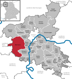
Werneck
Werneck | |
|---|---|
 Werneck Palace in Werneck, by Balthasar Neumann | |
| Coordinates: 49°59′N 10°6′E / 49.983°N 10.100°E | |
| Country | Germany |
| State | Bavaria |
| Admin. region | Unterfranken |
| District | Schweinfurt |
| Government | |
| • Mayor (2020–26) | Sebastian Hauck[1] (CSU) |
| Area | |
| • Total | 73.56 km2 (28.40 sq mi) |
| Elevation | 222 m (728 ft) |
| Population (2022-12-31)[2] | |
| • Total | 10,146 |
| • Density | 140/km2 (360/sq mi) |
| Time zone | UTC+01:00 (CET) |
| • Summer (DST) | UTC+02:00 (CEST) |
| Postal codes | 97440 |
| Dialling codes | 09722 |
| Vehicle registration | SW |
| Website | www.werneck.de |


Werneck is a market town in Schweinfurt in Lower Franconia, Bavaria, Germany.
Geography[change | change source]
Place[change | change source]
Werneck is in Lower Franconia in Bavaria, about 12 km from Schweinfurt and 25 km from Würzburg. It is on a curve in the Wern, a tributary of the Main, on the edge of the plateau above the river. Its highest point is at 337.20 m of elevation, its lowest at 212.50 m. The total area of the municipality is 73.65 km², of which about 9 km² are wooded.
Subdivisions[change | change source]
Werneck has the following districts:
- Eckartshausen
- Egenhausen
- Ettleben
- Eßleben
- Mühlhausen
- Rundelshausen
- Schleerieth
- Schnackenwerth
- Schraudenbach
- Stettbach
- Vasbühl
- Werneck
- Zeuzleben
References[change | change source]
- Manfred Fuchs. Chronik der jüdischen Gemeinde von Werneck. Spuren jüdischen Lebens 1677–1904. Werneck: Historisches Verein Markt Werneck, 2010 (in German)
- ↑ Liste der ersten Bürgermeister/Oberbürgermeister in kreisangehörigen Gemeinden, Bayerisches Landesamt für Statistik, 15 July 2021.
- ↑ Genesis Online-Datenbank des Bayerischen Landesamtes für Statistik Tabelle 12411-003r Fortschreibung des Bevölkerungsstandes: Gemeinden, Stichtag (Einwohnerzahlen auf Grundlage des Zensus 2011)
Other websites[change | change source]
Wikimedia Commons has media related to Werneck.
- Official website
 (in German)
 - Historischer Verein Markt Werneck (Historical Society)
- Denkmale in Werneck (Monuments) (requires agreement with terms of service)
- Werneck in Meyers Konversations-Lexikon, 4th ed. (1885–1892)


