Albrandswaard
Albrandswaard | |
|---|---|
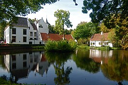
 View of Albrandswaard | |
| Coordinates: 51°51′35.6″N 4°25′16.4″E / 51.859889°N 4.421222°E | |
| Country | |
| Province | |
| Government | |
| • Mayor | Jolanda de Witte |
| Area | |
| • Total | 21.69 km2 (8.37 sq mi) |
| Population (January 1, 2001) | |
| • Total | 17,719 |
| • Density | 816.9/km2 (2,116/sq mi) |
| Time zone | UTC+01:00 (CET) |
| Postal code(s) | 3160–3162, 3165, 3170–3176 |
| Area code(s) | 010 |
| CIN | 0613 |
| Website | Official website |
Albrandswaard is a municipality in the Dutch province of South Holland. In 2019, 25,271 people lived there.
Albrandswaard has two settlements: Rhoon and Poortugaal.


