Adaminaby
(Redirected from Adaminaby, New South Wales)
| Adaminaby New South Wales | |
|---|---|
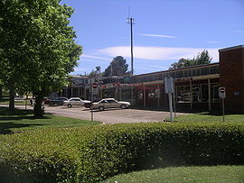
 Main street of Adaminaby, New South Wales | |
| Coordinates | 35°59′46″S 148°46′26″E / 35.99611°S 148.77389°E |
| Population | 301 (2016 census)[1] |
| Postcode(s) | 2629 |
| Elevation | 1,017 m (3,337 ft) |
| Location | |
| LGA(s) | Snowy Monaro Regional Council |
| County | Wallace |
| State electorate(s) | Monaro |
| Federal division(s) | Eden-Monaro |
Adaminaby (35°59′S 148°46′E / 35.983°S 148.767°E) is a town in southeast New South Wales, Australia on the Snowy Mountains Highway. The first town of Adaminaby was in the way of a new dam built on the Eucumbene River as part of the Snowy Mountains Scheme. In 1957 more than 100 buildings were relocated to a new site 10 kilometres away where they would not be flooded.[3] The name, Adaminaby is an Aboriginal word meaning a camp, or a resting place.[4] The town first started during the gold rush to Kiandra, New South Wales|Kiandra in 1860. It was first called Seymour, but the name was changed to Adaminaby in 1886.[4]
References[change | change source]
- ↑ Australian Bureau of Statistics (27 June 2017). "Adaminaby (State Suburb)". 2016 Census QuickStats. Retrieved 6 July 2017.
- ↑ Distances calculated using Travelmate Map Maker Archived 25 March 2007 at the Wayback Machine
- ↑ "Adaminaby". www.snowymountains.com.au. Archived from the original on 2007-04-30. Retrieved 2009-04-28.
- ↑ 4.0 4.1 "Extract - Geographical Names Board". gnb.nsw.gov.au. Retrieved 8 April 2010.[permanent dead link]

