's-Hertogenbosch
Appearance
's-Hertogenbosch
Den Bosch | |
|---|---|
City and municipality | |
|
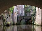
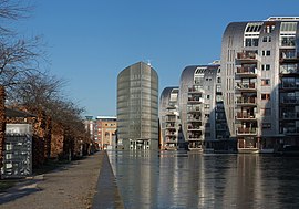
From top down, left to right: view over the city centre, the city seen from the Bossche Brook, Binnendieze canals, Province Hall of North Brabant, St. Catherine Church, New St. James Church, Dragon Fountain, Hieronymus Bosch, North Brabant Museum, St. John's Cathedral, City hall of 's-Hertogenbosch, Paleiskwartier | |
 Location in North Brabant | |
| Coordinates: 51°41′N 5°18′E / 51.683°N 5.300°E | |
| Country | Netherlands |
| Province | North Brabant |
| Government | |
| • Body | Municipal council |
| • Mayor | Jack Mikkers (VVD) |
| Area | |
| • Municipality | 117.81 km2 (45.49 sq mi) |
| • Land | 109.99 km2 (42.47 sq mi) |
| • Water | 7.82 km2 (3.02 sq mi) |
| Elevation | 6 m (20 ft) |
| Population | |
| • Municipality | 154,205 |
| • Density | 1,402/km2 (3,630/sq mi) |
| • Urban | 169,714 |
| • Metro | 198,000 |
| • Metro region | 355,230 |
| • Brabant CMSA | 1,932,055 |
| Demonym | Bosschenaar |
| Time zone | UTC+1 (CET) |
| • Summer (DST) | UTC+2 (CEST) |
| Postcode | 5200–5249 |
| Area code | 073 |
| Website | s-hertogenbosch |
's-Hertogenbosch (![]() ˌsɛrtoːɣə(n)ˈbɔs (help·info)) is a municipality in the Netherlands, and also the capital of the province of North Brabant. It is in the southern Netherlands, 80 kilometres (50 mi) south of Amsterdam.
ˌsɛrtoːɣə(n)ˈbɔs (help·info)) is a municipality in the Netherlands, and also the capital of the province of North Brabant. It is in the southern Netherlands, 80 kilometres (50 mi) south of Amsterdam.
In 2015, Maasdonk became a part to 's-Hertogenbosch.
References
[change | change source]- ↑ "Samenstelling van het college" [Members of the board] (in Dutch). Gemeente 's-Hertogenbosch. Archived from the original on 25 December 2018. Retrieved 12 April 2014.
- ↑ "Kerncijfers wijken en buurten 2020" [Key figures for neighbourhoods 2020]. StatLine (in Dutch). CBS. 24 July 2020. Retrieved 19 September 2020.
- ↑ "Postcodetool for 5211HH". Actueel Hoogtebestand Nederland (in Dutch). Het Waterschapshuis. Archived from the original on 21 September 2013. Retrieved 15 April 2014.
- ↑ "Bevolkingsontwikkeling; regio per maand" [Population growth; regions per month]. CBS Statline (in Dutch). CBS. 1 January 2019. Retrieved 1 January 2019.
- ↑ "Bevolkingsontwikkeling; Regionale kerncijfers Nederland" [Regional core figures Netherlands]. CBS Statline (in Dutch). CBS. 1 January 2020. Retrieved 8 March 2021.
- ↑ "De grenzeloze regio". Sdu uitgevers. 2007. ISBN 9789012124577.
Het BBP van BrabantStad ligt op 14.7% van het nationale BBP. In de regio liggen Philips, de Technische Universiteit Eindhoven, de Universiteit Tilburg en de HAS Den Bosch. De regio heeft 1.4 miljoen inwoners. Er is veel R&D, ICT, automotive, logistiek en agribusiness.
- Notes
- ↑ ‘Metropolitan region Waalboss’
Stedelijke regio streekplan Waalboss
143,733 – 's-Hertogenbosch
84,954 – Oss
46,498 – Waalwijk
43,165 – Heusden
25,638 – Vught
11,242 – Maasdonk
+ 355,230
Other websites
[change | change source]Wikimedia Commons has media related to 's-Hertogenbosch.


