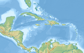
Belize Barrier Reef
| Belize Barrier Reef | |
|---|---|
 The Barrier Reef is clearly visible along the eastern coast of Belize in the Caribbean Sea. | |
| Location | Belize |
| Nearest city | Belize City, Belize |
| Coordinates | 17°18′56″N 87°32′4″W / 17.31556°N 87.53444°W |
| Official name | Belize Barrier Reef Reserve System |
| Type | Natural |
| Criteria | vii, ix, x |
| Designated | 1996 (20th session) |
| Reference no. | 764 |
| State Party | Belize |
| Region | Latin America and the Caribbean |
| Endangered | 2009–2018 |
The Belize Barrier Reef is a series of coral reefs. It goes along the coast of Belize, about 300 meters (980 ft) offshore in the north and 40 kilometers (25 mi) in the south. The Belize Barrier Reef is a 300 kilometers (190 mi) long section of the 900 kilometers (560 mi) long Mesoamerican Barrier Reef System. The reef system runs continuous from Cancún on the northeast tip of the Yucatán Peninsula through the Riviera Maya down to Honduras. This makes it one of the largest coral reef systems in the world after the Great Barrier Reef in Australia and the New Caledonia Barrier Reef.
Charles Darwin described it as "the most remarkable reef in the West Indies" in 1842.[1]
Species
[change | change source]The Belize Barrier Reef is home to many different plants and animals. There are:
- 70 hard coral species
- 36 soft coral species
- 500 species of fish
- hundreds of invertebrate species
About 90% of the reef still needs to be researched. It is thought that only 10% of all species have been discovered.[2]
References
[change | change source]- ↑ Darwin, Charles 1842. The structure and distribution of coral reefs. London: Murray.
- ↑ Belize Barrier Reef Case Study Archived 2013-06-05 at the Wayback Machine. Westminster.edu. Retrieved on 2011-10-21.


