Chemung River
Appearance
| Chemung River | |
|---|---|
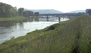
 The Chemung River at Elmira, New York | |
| Location | |
| Country | United States |
| State | New York, Pennsylvania |
| Counties | Steuben, NY, Chemung, NY, Bradford, PA |
| Cities | Corning, Elmira |
| Physical characteristics | |
| Source | Tioga River |
| - location | Armenia Township |
| - coordinates | 41°45′40″N 76°51′39″W / 41.76111°N 76.86083°W |
| 2nd source | Cohocton River |
| - location | Tabor Corners |
| - coordinates | 42°39′26″N 77°31′56″W / 42.65722°N 77.53222°W |
| Source confluence | |
| - location | Painted Post |
| - coordinates | 42°9′7″N 77°5′25″W / 42.15194°N 77.09028°W[2] |
| - elevation | 935 ft (285 m) |
| Mouth | Susquehanna River |
| - location | Sayre, PA |
| - coordinates | 41°55′19″N 76°30′56″W / 41.92194°N 76.51556°W[2] |
| - elevation | 722 ft (220 m)[1] |
| Length | 46 mi (74 km) |
| Basin size | 2,506 sq mi (6,490 km2)[3] |
| Discharge | |
| - location | Chemung, NY[3] |
| - average | 2,623 cu ft/s (74.3 m3/s)[3] |
| - minimum | 113 cu ft/s (3.2 m3/s) |
| - maximum | 65,400 cu ft/s (1,850 m3/s) |
The Chemung River (/ʃəˈmʌŋ/ shə-MUNG) is a tributary of the Susquehanna River, about 46.4 miles (74.7 km) long,[4] in south central New York and northern Pennsylvania in the United States. It drains a mountainous region of the northern Allegheny Plateau in the Southern Tier of New York.
References
[change | change source]- ↑ Google Earth elevation for GNIS coordinates.
- ↑ 2.0 2.1 "Chemung River". Geographic Names Information System. United States Geological Survey. Retrieved September 10, 2016.
- ↑ 3.0 3.1 3.2 Water Resources Data New York Water Year 2003, Volume 3: Western New York, USGS
- ↑ U.S. Geological Survey. National Hydrography Dataset high-resolution flowline data. The National Map Archived 2012-03-29 at the Wayback Machine, accessed August 8, 2011
