
File:(Albi) Le Tarn vu du vieux pont vers l'ouest.jpg

Size of this preview: 800 × 451 pixels. Other resolutions: 320 × 181 pixels | 640 × 361 pixels | 1,024 × 578 pixels | 1,280 × 722 pixels | 2,560 × 1,445 pixels | 8,256 × 4,659 pixels.
Original file (8,256 × 4,659 pixels, file size: 37.24 MB, MIME type: image/jpeg)
| This is a file from the Wikimedia Commons. Information from its description page there is shown below. Commons is a freely licensed media file repository. You can help. |
Summary
|
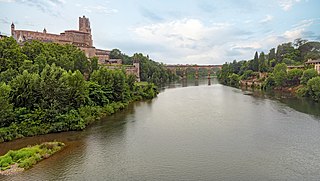
Tarn River in Albi - seen from the old bridge to the west. | ||||||||||||||||||||||
|
| ||||||||||||||||||||||


_du_moulin_sur_le_Tarn,_vue_du_pont_de_Rabastens.jpg)
_Le_Tarn_vu_du_vieux_pont_vers_l%27ouest.jpg)
_Le_Tarn_vu_du_vieux_pont_vers_l%27ouest.jpg)
_Le_Tarn_vu_du_vieux_pont_vers_l%27ouest.jpg)
_Le_Tarn_vu_du_vieux_pont_vers_l%27ouest.jpg¶ms=043.931360_N_0002.144439_E_globe:Earth_type:camera_region:FR_&language=en)
| Annotations | This image is annotated: View the annotations at Commons |
File history
Click on a date/time to view the file as it appeared at that time.
| Date/Time | Thumbnail | Dimensions | User | Comment | |
|---|---|---|---|---|---|
| current | 18:51, 21 September 2021 | | 8,256 × 4,659 (37.24 MB) | Archaeodontosaurus | {{Information |Description= |Source={{own}} |Date= |Author= Archaeodontosaurus |Permission= |other_versions= }} |
File usage
The following page uses this file:
Global file usage
The following other wikis use this file:
- Usage on ar.wikipedia.org
- Usage on ast.wikipedia.org
- Usage on az.wikipedia.org
- Usage on bg.wikipedia.org
- Usage on ca.wikipedia.org
- Usage on ceb.wikipedia.org
- Usage on ce.wikipedia.org
- Usage on cs.wikipedia.org
- Usage on cy.wikipedia.org
- Usage on de.wikivoyage.org
- Usage on el.wikipedia.org
- Usage on en.wikipedia.org
- Usage on en.wikivoyage.org
- Usage on es.wikipedia.org
- Usage on et.wikipedia.org
- Usage on fr.wikipedia.org
- Usage on fr.wikinews.org
- Usage on fr.wikivoyage.org
- Usage on gl.wikipedia.org
- Usage on he.wikipedia.org
- Usage on hy.wikipedia.org
- Usage on ia.wikipedia.org
- Usage on it.wikipedia.org
- Usage on it.wikivoyage.org
- Usage on ja.wikipedia.org
- Usage on lld.wikipedia.org
- Usage on mk.wikipedia.org
- Usage on mt.wikipedia.org
- Usage on oc.wikipedia.org
- Usage on os.wikipedia.org
- Usage on pms.wikipedia.org
- Usage on pt.wikipedia.org
- Usage on ro.wikipedia.org
- Usage on ru.wikipedia.org
- Usage on sco.wikipedia.org
- Usage on sh.wikipedia.org
- Usage on sk.wikipedia.org
- Usage on sr.wikipedia.org
- Usage on uk.wikipedia.org
- Usage on ur.wikipedia.org
- Usage on www.wikidata.org
- Usage on zh-min-nan.wikipedia.org
View more global usage of this file.
_Le_Tarn_vu_du_vieux_pont_vers_l%27ouest.jpg)
_Le_Tarn_vu_du_vieux_pont_vers_l%27ouest.jpg)