
File:Administrative divisions of Germany, February 1944.png
Size of this preview: 773 × 600 pixels. Other resolutions: 310 × 240 pixels | 619 × 480 pixels | 990 × 768 pixels | 1,280 × 993 pixels | 2,607 × 2,022 pixels.
Original file (2,607 × 2,022 pixels, file size: 577 KB, MIME type: image/png)
| This is a file from the Wikimedia Commons. Information from its description page there is shown below. Commons is a freely licensed media file repository. You can help. |
Summary
| Description |
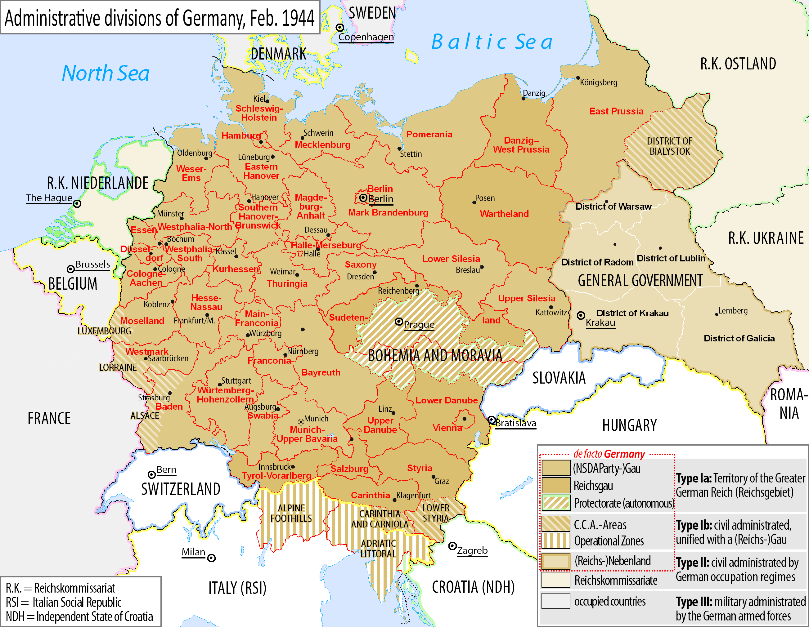
English: Map of the NSDAP administrative divisions of Germany, February 1944.
Deutsch: Englischsprachige Karte der administrative Gliederung des Großdeutschen Reiches durch die NSDAP 1944.
Polski: Mapa Wielkiej Rzeszy Niemieckiej (1944) |
||||
| Date | |||||
| Source | File:Grossdeutsches_Reich_NS_Administration_1944.png | ||||
| Author | DIREKTOR (derived from Exec's file) | ||||
| Permission (Reusing this file) |
This file is licensed under the Creative Commons Attribution-Share Alike 4.0 International license.
|
||||
| Other versions |
|


File history
Click on a date/time to view the file as it appeared at that time.
| Date/Time | Thumbnail | Dimensions | User | Comment | |
|---|---|---|---|---|---|
| current | 12:25, 8 October 2021 | | 2,607 × 2,022 (577 KB) | Kamilhrub | Corrected border of Lublin and Galicia districts, which didn't change after 1941 (source: Amtliches Gemeinde- und Dorfverzeichnis für das Generalgouvernement auf Grund der Summarischen Bevölkerungsbestandsaufnahme am 1. März 1943) |
| 05:36, 5 February 2017 |  | 2,607 × 2,022 (563 KB) | DIREKTOR | Legend frames. | |
| 13:23, 4 February 2017 |  | 2,607 × 2,022 (563 KB) | DIREKTOR | Further error corrections ("Francfort", "Berne", etc.) | |
| 11:08, 4 February 2017 |  | 2,607 × 2,022 (594 KB) | DIREKTOR | Error corrections. | |
| 12:49, 3 February 2017 |  | 2,607 × 2,022 (614 KB) | DIREKTOR | User created page with UploadWizard |
File usage
There are no pages that use this file.