
File:Bassin de la Meuse.svg

Size of this PNG preview of this SVG file: 396 × 600 pixels. Other resolutions: 158 × 240 pixels | 317 × 480 pixels | 507 × 768 pixels | 676 × 1,024 pixels | 1,352 × 2,048 pixels | 660 × 1,000 pixels.
Original file (SVG file, nominally 660 × 1,000 pixels, file size: 226 KB)
| This is a file from the Wikimedia Commons. Information from its description page there is shown below. Commons is a freely licensed media file repository. You can help. |
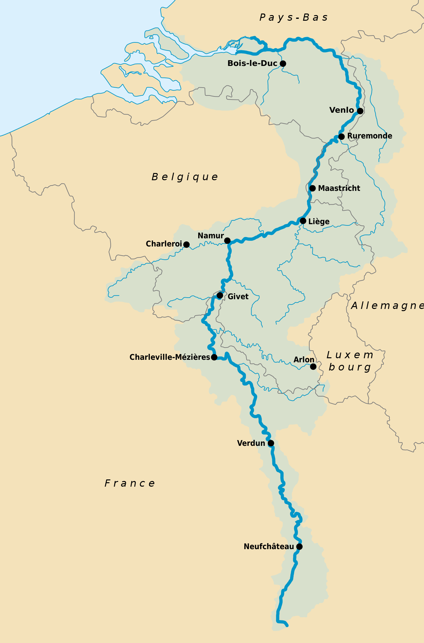
| Description | Carte représentant l'importance du Bassin de la Meuse en Wallonie | ||||||||
| Date | |||||||||
| Source | Image:Meuse basin.jpg | ||||||||
| Author | Own Work, svg and inspired by Image:Meuse basin.jpg | ||||||||
| Permission (Reusing this file) |
I, the copyright holder of this work, hereby publish it under the following licenses:
You may select the license of your choice. |
||||||||
| Other versions |
|


File history
Click on a date/time to view the file as it appeared at that time.
| Date/Time | Thumbnail | Dimensions | User | Comment | |
|---|---|---|---|---|---|
| current | 15:23, 25 July 2020 | | 660 × 1,000 (226 KB) | Mapeh | Erreur Aix-la-Chapelle |
| 11:36, 11 June 2020 |  | 660 × 1,000 (227 KB) | Mapeh | Modification du contour du bassin, ajout de plus de villes | |
| 16:25, 7 June 2020 |  | 660 × 1,000 (225 KB) | Mapeh | Modification pour corriger un problème de rasterisation | |
| 16:19, 7 June 2020 |  | 660 × 1,000 (225 KB) | Mapeh | Nouvelle version | |
| 22:21, 27 March 2013 |  | 660 × 1,000 (328 KB) | Io Herodotus | blue see | |
| 14:46, 3 January 2007 |  | 660 × 1,000 (322 KB) | Nicolas Lardot~commonswiki | {{Information |Description=Carte représentant l'importance du Bassin de la Meuse en Wallonie |Source=Image:Meuse basin.jpg |Date=3 January 2007 |Author=Own Work, svg and inspired by Image:Meuse basin.jpg |Permission={{GFDL-self}} |other_version |
File usage
There are no pages that use this file.
Global file usage
The following other wikis use this file:
- Usage on azb.wikipedia.org
- Usage on bn.wikipedia.org
- Usage on cs.wikipedia.org
- Usage on en.wikipedia.org
- Usage on eo.wikipedia.org
- Usage on fa.wikipedia.org
- Usage on fr.wikipedia.org
- Usage on fr.wikinews.org
- Usage on fr.wiktionary.org
- Usage on he.wikipedia.org
- Usage on it.wikipedia.org
- Usage on ky.wikipedia.org
- Usage on lb.wikipedia.org
- Usage on no.wikipedia.org
- Usage on pa.wikipedia.org
- Usage on pl.wikipedia.org
- Usage on pl.wiktionary.org
- Usage on pms.wikipedia.org
- Usage on pnb.wikipedia.org
- Usage on pt.wikipedia.org
- Usage on ro.wikipedia.org
- Usage on sk.wikipedia.org
- Usage on sl.wikipedia.org
- Usage on ta.wikipedia.org
- Usage on tl.wikipedia.org
- Usage on www.wikidata.org