
File:Blank France map, no Departments.svg

Size of this PNG preview of this SVG file: 507 × 520 pixels. Other resolutions: 234 × 240 pixels | 468 × 480 pixels | 749 × 768 pixels | 998 × 1,024 pixels | 1,997 × 2,048 pixels.
Original file (SVG file, nominally 507 × 520 pixels, file size: 16 KB)
| This is a file from the Wikimedia Commons. Information from its description page there is shown below. Commons is a freely licensed media file repository. You can help. |
Clickable version
| Description |
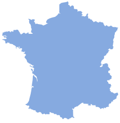
English: Map showing France without departemental borders. |
||||
| Date | 5 July 2007 (upload date) | ||||
| Source |
|
||||
| Author | Lokal_Profil | ||||
| Permission (Reusing this file) |
Original image licensed under
|
File history
Click on a date/time to view the file as it appeared at that time.
| Date/Time | Thumbnail | Dimensions | User | Comment | |
|---|---|---|---|---|---|
| current | 16:24, 5 July 2007 | | 507 × 520 (16 KB) | Lokal Profil | {{Information |Description={{en|Map showing France without departemental borders.}} |Source=*Vector map from Image:Départements de France-simple.svg by SuperManu. *Modified by Lokal_Profil |Date=05-07 |
File usage
There are no pages that use this file.
Global file usage
The following other wikis use this file:
- Usage on cs.wiktionary.org
- Usage on de.wikipedia.org
- Usage on fr.wikipedia.org
- Géographie de la Bourgogne
- Champagne humide
- Lomagne
- Catégorie:Wikipédia:ébauche géographie de la France
- Côte-sous-le-vent
- Côte-au-vent
- Canal de Craponne
- Massif ardennais
- Côte atlantique française
- Grand Ouest français
- Plateau de Vassieux
- Côtes de Moselle
- Pas de l'Escalette
- Tunnel du Pas de l'Escalette
- Blayais
- Tunnel de la Vierge
- Wikipédia:Liste de bandeaux d'ébauches de géographie/France
- Frontière entre l'Australie et la France
- Frontière entre la France et Maurice
- Frontière entre la France et Madagascar
- Frontière entre la France et les Seychelles
- Frontière entre la France et les Îles Salomon
- Frontière entre la France et le Vanuatu
- Frontière entre la France et les Kiribati
- Frontière entre la France et les Samoa
- Cubzaguais
- Grand Est français
- Zone d'activité économique
- Bassin de vie
- La Caume
- Arc atlantique
- Utilisateur:The Obento Musubi/Userbox/Français
- Pays Coupés
- Bassin de la Seine
- Frontières du Nord-Pas-de-Calais
- Bassin versant de la Dordogne
- Cap d'Estaing
- Col de la Croix de Mounis
- Canal de la vallée des Baux
- Frontière entre la France et le Mozambique
- Salins de Frontignan
- Lido de Thau
- Mondial de l'automobile de Paris 2018
- Orxois
- Modèle:Première française
- Modèle:Première française/Documentation
- Gorges de la Vingeanne
- Usage on hr.wiktionary.org