
File:England Region - London.svg

Size of this PNG preview of this SVG file: 484 × 599 pixels. Other resolutions: 194 × 240 pixels | 388 × 480 pixels | 620 × 768 pixels | 827 × 1,024 pixels | 1,654 × 2,048 pixels | 525 × 650 pixels.
Original file (SVG file, nominally 525 × 650 pixels, file size: 83 KB)
| This is a file from the Wikimedia Commons. Information from its description page there is shown below. Commons is a freely licensed media file repository. You can help. |
Summary
| Description |
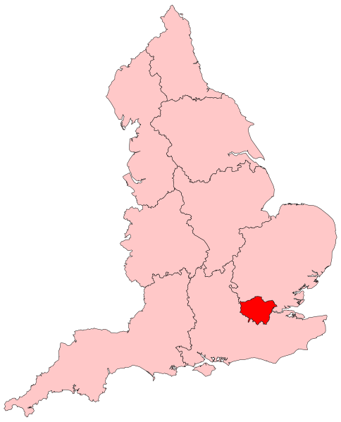
English: Locator map showing the London region of England |
| Date | |
| Source | Own work (Original text: Own work by uploader, based on File:2005UKElectionMap.svg) |
| Author | Ch1902 |
| Other versions |
|
| SVG development |

Licensing
| I, the copyright holder of this work, release this work into the public domain. This applies worldwide. In some countries this may not be legally possible; if so: I grant anyone the right to use this work for any purpose, without any conditions, unless such conditions are required by law. |
File history
Click on a date/time to view the file as it appeared at that time.
| Date/Time | Thumbnail | Dimensions | User | Comment | |
|---|---|---|---|---|---|
| current | 17:15, 30 May 2009 | | 525 × 650 (83 KB) | Ch1902 | {{Information |Description={{en|1=Locator map showing the London region of England}} |Source=Own work by uploader, based on File:2005UKElectionMap.svg |Date=2009-05-30 |Author=Ch1902 |Permission= |other_versions= }} [[Category:SVG map |
File usage
The following page uses this file:
Global file usage
The following other wikis use this file:
- Usage on an.wikipedia.org
- Usage on ay.wikipedia.org
- Usage on be.wikipedia.org
- Usage on bn.wikipedia.org
- Usage on ca.wikipedia.org
- Usage on ceb.wikipedia.org
- Usage on cs.wikipedia.org
- Usage on cy.wikipedia.org
- Northolt
- Brixton
- Kew
- Chislehurst
- Croydon
- Richmond upon Thames
- Llundain Fwyaf
- Parliament Hill
- Kingston upon Thames
- Kingston upon Thames (Bwrdeistref Frenhinol)
- Richmond upon Thames (Bwrdeistref Llundain)
- Surbiton
- Merton (Bwrdeistref Llundain)
- Hounslow (Bwrdeistref Llundain)
- Ealing (Bwrdeistref Llundain)
- Brent (Bwrdeistref Llundain)
- Camden (Bwrdeistref Llundain)
- Hillingdon (Bwrdeistref Llundain)
- Harrow (Bwrdeistref Llundain)
- Barnet (Bwrdeistref Llundain)
- Enfield (Bwrdeistref Llundain)
- Waltham Forest (Bwrdeistref Llundain)
- Redbridge (Bwrdeistref Llundain)
- Havering (Bwrdeistref Llundain)
- Bexley (Bwrdeistref Llundain)
- Bromley (Bwrdeistref Llundain)
- Croydon (Bwrdeistref Llundain)
- Sutton (Bwrdeistref Llundain)
- Haringey (Bwrdeistref Llundain)
- Newham (Bwrdeistref Llundain)
- Barking a Dagenham (Bwrdeistref Llundain)
- Bwrdeistref Llundain
- Greenwich (Bwrdeistref Frenhinol)
- Lewisham (Bwrdeistref Llundain)
- Islington (Bwrdeistref Llundain)
- Hackney (Bwrdeistref Llundain)
- Tower Hamlets (Bwrdeistref Llundain)
- Hounslow
- Chiswick
View more global usage of this file.