
File:Georgia Kvemo Kartli location map.svg

Size of this PNG preview of this SVG file: 753 × 444 pixels. Other resolutions: 320 × 189 pixels | 640 × 377 pixels | 1,024 × 604 pixels | 1,280 × 755 pixels | 2,560 × 1,509 pixels.
Original file (SVG file, nominally 753 × 444 pixels, file size: 637 KB)
| This is a file from the Wikimedia Commons. Information from its description page there is shown below. Commons is a freely licensed media file repository. You can help. |
Summary
| Description |
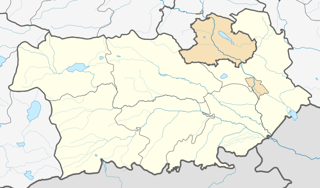
English: Georgia Kvemo Kartli location map
ქართული: ქვემო ქართლის გეორეფერენსირებული რუკა
Equirectangular projection, N/S stretching 135 %. Geographic limits of the map:
|
||
| Date | |||
| Source | Own work | ||
| Author | Giorgi Balakhadze | ||
| SVG | W3C-validity not checked. |


Licensing
Giorgi Balakhadze at Wikimedia Foundation, the copyright holder of this work, hereby publishes it under the following license:
This file is licensed under the Creative Commons Attribution-Share Alike 4.0 International license.
Attribution: Giorgi Balakhadze at Wikimedia Foundation
- You are free:
- to share – to copy, distribute and transmit the work
- to remix – to adapt the work
- Under the following conditions:
- attribution – You must give appropriate credit, provide a link to the license, and indicate if changes were made. You may do so in any reasonable manner, but not in any way that suggests the licensor endorses you or your use.
- share alike – If you remix, transform, or build upon the material, you must distribute your contributions under the same or compatible license as the original.
File history
Click on a date/time to view the file as it appeared at that time.
| Date/Time | Thumbnail | Dimensions | User | Comment | |
|---|---|---|---|---|---|
| current | 12:30, 20 February 2018 | | 753 × 444 (637 KB) | Giorgi Balakhadze | User created page with UploadWizard |
File usage
The following 2 pages use this file:
Global file usage
The following other wikis use this file:
- Usage on az.wikipedia.org
- Usage on ce.wikipedia.org
- Рустави
- Болниси
- Гардабани
- Дманиси
- Марнеули
- Тетри-Цкаро
- Цалка
- Казрети
- Тамариси (Болнисин муниципалитет)
- Акаурта
- Балахаури
- Баличи (Гуьржийчоь)
- Бертакари
- Ванати (Болнисин муниципалитет)
- Дарбази
- Джавшаниани
- Дзвели-Квеши
- Дзедзвнариани
- Зварети (Болнисин муниципалитет)
- Земо-Аркевани
- Ицриа
- Квемо-Аркевани
- Квемо-Болниси
- Мамхути
- Мухрана
- Мушевани
- Мцкнети
- Нахидури
- Патара-Дарбази
- Поладаури
- Поцхвериани
- Ратевани
- Рачисубани
- Саберети
- Саванети
- Самтредо
- Самцевриси
- Сенеби
- Талавери
- Тандзиа
- Хатавети
- Хахаладжвари
- Хидискури (Болнисин муниципалитет)
- Ципори (Болнисин муниципалитет)
- Цуртави
- Чапала
- Чреши
View more global usage of this file.