
File:India Kerala relief map.png
Size of this preview: 412 × 600 pixels. Other resolutions: 165 × 240 pixels | 330 × 480 pixels | 828 × 1,205 pixels.
Original file (828 × 1,205 pixels, file size: 933 KB, MIME type: image/png)
| This is a file from the Wikimedia Commons. Information from its description page there is shown below. Commons is a freely licensed media file repository. You can help. |
Summary
| Description |
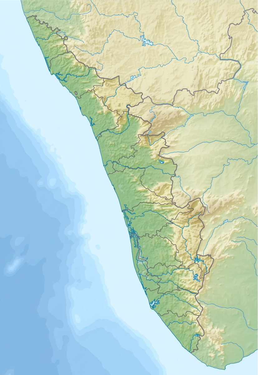
English: Relief map of Kerala, India. |
|||||||||
| Date | ||||||||||
| Source |
|
|||||||||
| Creator | ||||||||||
| Geotemporal data | ||||||||||
| Bounding box |
|
|||||||||
| Georeferencing | If inappropriate please set warp_status = skip to hide. | |||||||||
| Other versions |
|
|||||||||

Licensing
I, the copyright holder of this work, hereby publish it under the following license:
This file is licensed under the Creative Commons Attribution-Share Alike 4.0 International license.
- You are free:
- to share – to copy, distribute and transmit the work
- to remix – to adapt the work
- Under the following conditions:
- attribution – You must give appropriate credit, provide a link to the license, and indicate if changes were made. You may do so in any reasonable manner, but not in any way that suggests the licensor endorses you or your use.
- share alike – If you remix, transform, or build upon the material, you must distribute your contributions under the same or compatible license as the original.
File history
Click on a date/time to view the file as it appeared at that time.
| Date/Time | Thumbnail | Dimensions | User | Comment | |
|---|---|---|---|---|---|
| current | 12:54, 23 August 2017 | | 828 × 1,205 (933 KB) | Nzeemin | User created page with UploadWizard |
File usage
The following 2 pages use this file:
Global file usage
The following other wikis use this file:
- Usage on bh.wikipedia.org
- Usage on bn.wikipedia.org
- Usage on cv.wikipedia.org
- Usage on de.wikipedia.org
- Usage on eo.wikipedia.org
- Usage on fa.wikipedia.org
- Usage on frr.wikipedia.org
- Usage on fr.wikipedia.org
- Kozhikode
- Cranganore
- Cannanore
- Cochin (Inde)
- Cap Comorin
- Thiruvananthapuram
- Thrissur
- Kottayam
- Parc national de Mathikettan Shola
- Thalassery
- Angamaly
- Palakkad
- Alappuzha
- Pathanamthitta
- Pattambi
- Quilon
- Modèle:Géolocalisation/Kerala
- Sultan Bathery
- Vypin
- Aluva
- Willingdon Island
- Kanam
- Kuttanad
- Kumarakom
- Lac Vembanad
- Malappuram
- Munnar
- Guruvayur
View more global usage of this file.