
File:Locatie Medemblik.svg

Size of this PNG preview of this SVG file: 421 × 196 pixels. Other resolutions: 320 × 149 pixels | 640 × 298 pixels | 1,024 × 477 pixels | 1,280 × 596 pixels | 2,560 × 1,192 pixels.
Original file (SVG file, nominally 421 × 196 pixels, file size: 63 KB)
| This is a file from the Wikimedia Commons. Information from its description page there is shown below. Commons is a freely licensed media file repository. You can help. |
Summary
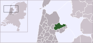
| Description | Locator map of municipality Medemblik (Netherlands) (from 2007) |
| Date | |
| Source | Own work, based on freely available GIS data |
| Author | User:Mtcv |
| Permission (Reusing this file) |
Data: attribution required; my work: PD |
Licensing

|
The copyright holder of this file, Centraal Bureau voor de Statistiek, allows anyone to use it for any purpose, provided that the copyright holder is properly attributed. Redistribution, derivative work, commercial use, and all other use is permitted. |
Attribution:
|
File history
Click on a date/time to view the file as it appeared at that time.
| Date/Time | Thumbnail | Dimensions | User | Comment | |
|---|---|---|---|---|---|
| current | 19:01, 3 February 2012 | | 421 × 196 (63 KB) | Gladiool | Same style as other maps + 2012 municipality borders |
| 13:24, 27 January 2011 |  | 840 × 450 (186 KB) | VYGOcommons | Medemblik after merger with Andijk and Wervershoof | |
| 01:09, 2 January 2007 |  | 840 × 450 (188 KB) | Mtcv | {{Information| |Description=Locator map of municipality Medemblik (Netherlands) (from 2007) |Source=Own work, based on freely available GIS data |Date=2007-01-02 |Author=User:Mtcv |Permission=Data: attribution required; my work: PD }} |
File usage
There are no pages that use this file.
Global file usage
The following other wikis use this file:
- Usage on ar.wikipedia.org
- Usage on br.wikipedia.org
- Usage on fa.wikipedia.org
- Usage on fr.wikipedia.org
- Usage on lt.wikipedia.org
- Usage on nl.wikivoyage.org
- Usage on pt.wikipedia.org
- Usage on ro.wikipedia.org
- Usage on ru.wikipedia.org
- Usage on sv.wikipedia.org
- Usage on tr.wikipedia.org
- Usage on ur.wikipedia.org
- Usage on vi.wikipedia.org
- Usage on www.wikidata.org
- Usage on zh-min-nan.wikipedia.org