
File:Relief Map of Kemerovo Oblast.jpg

Size of this preview: 418 × 600 pixels. Other resolutions: 167 × 240 pixels | 334 × 480 pixels | 535 × 768 pixels | 1,200 × 1,722 pixels.
Original file (1,200 × 1,722 pixels, file size: 540 KB, MIME type: image/jpeg)
| This is a file from the Wikimedia Commons. Information from its description page there is shown below. Commons is a freely licensed media file repository. You can help. |
Summary
| Description |
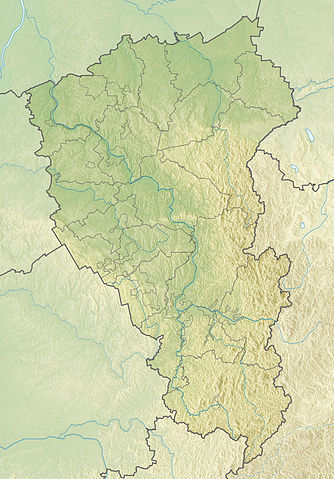
Русский: Физическая карта Кемеровской области
|top = 57 |bottom = 52 |left = 84 |right = 90 |
| Date | |
| Source | |
| Author | |
| Other versions |
[] |


Licensing
This file is licensed under the Creative Commons Attribution-Share Alike 2.0 Generic license.
- You are free:
- to share – to copy, distribute and transmit the work
- to remix – to adapt the work
- Under the following conditions:
- attribution – You must give appropriate credit, provide a link to the license, and indicate if changes were made. You may do so in any reasonable manner, but not in any way that suggests the licensor endorses you or your use.
- share alike – If you remix, transform, or build upon the material, you must distribute your contributions under the same or compatible license as the original.
File history
Click on a date/time to view the file as it appeared at that time.
| Date/Time | Thumbnail | Dimensions | User | Comment | |
|---|---|---|---|---|---|
| current | 08:33, 27 November 2010 | | 1,200 × 1,722 (540 KB) | Виктор В | == {{int:filedesc}} == {{Information |Description={{ru|1=Физическая карта Кемеровской области *Проекция — равноугольная. *Стандартная параллель — 54°30′00″с.ш. *Пара� |
File usage
The following 2 pages use this file:
Global file usage
The following other wikis use this file:
- Usage on ar.wikipedia.org
- Usage on be.wikipedia.org
- Usage on bg.wikipedia.org
- Яя (Русия)
- Яшкино
- Новокузнецк
- Кемерово
- Прокопевск
- Шаблон:ПК Русия Кемеровска област
- Белово (Кемеровска област)
- Гуревск (Кемеровска област)
- Калтан
- Мариинск
- Междуреченск (Кемеровска област)
- Осинники
- Полисаево
- Салаир
- Тайга (град)
- Тащагол
- Топки
- Юрга
- Кузнецки Алатау
- Кузнецка котловина
- Салаирско възвишение
- Usage on ceb.wikipedia.org
- Usage on ce.wikipedia.org
- Usage on cs.wikipedia.org
- Usage on cv.wikipedia.org
- Usage on da.wikipedia.org
- Usage on de.wikipedia.org
- Usage on el.wikipedia.org
- Usage on en.wikipedia.org
- Usage on eo.wikipedia.org
View more global usage of this file.