
File:Ryhall Belmesthorpe station-Geograph-1636985-by-Brian-Green.jpg
No higher resolution available.
Ryhall_Belmesthorpe_station-Geograph-1636985-by-Brian-Green.jpg (640 × 480 pixels, file size: 133 KB, MIME type: image/jpeg)
| This is a file from the Wikimedia Commons. Information from its description page there is shown below. Commons is a freely licensed media file repository. You can help. |
Summary
| Description |
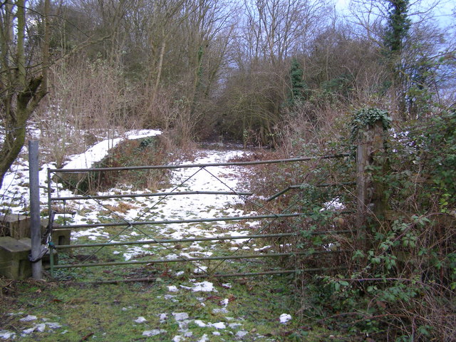
English: Disused Belmesthorpe railway station This locked gateway is where the level crossing gate would have been at the Belmesthorpe/Ryhall station on the dismantled railway line between Stamford and Essendine. |
| Date | |
| Source | From geograph.org.uk |
| Author | Brian Green |
| Permission (Reusing this file) |
Creative Commons Attribution Share-alike license 2.0 |
| Attribution (required by the license) | Brian Green / Disused Belmesthorpe railway station / |
| Camera location | | View this and other nearby images on: OpenStreetMap |
|---|
Licensing

|
This image was taken from the Geograph project collection. See this photograph's page on the Geograph website for the photographer's contact details. The copyright on this image is owned by Brian Green and is licensed for reuse under the Creative Commons Attribution-ShareAlike 2.0 license.
|
This file is licensed under the Creative Commons Attribution-Share Alike 2.0 Generic license.
Attribution: Brian Green
- You are free:
- to share – to copy, distribute and transmit the work
- to remix – to adapt the work
- Under the following conditions:
- attribution – You must give appropriate credit, provide a link to the license, and indicate if changes were made. You may do so in any reasonable manner, but not in any way that suggests the licensor endorses you or your use.
- share alike – If you remix, transform, or build upon the material, you must distribute your contributions under the same or compatible license as the original.
File history
Click on a date/time to view the file as it appeared at that time.
| Date/Time | Thumbnail | Dimensions | User | Comment | |
|---|---|---|---|---|---|
| current | 07:11, 15 December 2010 | | 640 × 480 (133 KB) | Robert EA Harvey | == {{int:filedesc}} == {{Information |Description={{en|1=Disused Belmesthorpe railway station}} |Source=From [http://www.geograph.org.uk/photo/1636985 geograph.org.uk] |Date=2009-12-26 |Author=[http://www.geograph.org.uk/profile/8417 Brian Green] |Permiss |
File usage
The following page uses this file:
Global file usage
The following other wikis use this file:
- Usage on arz.wikipedia.org
- Usage on en.wikipedia.org
- Usage on www.wikidata.org