
File:Sulphur Tornado Radar Image.png
Size of this preview: 800 × 394 pixels. Other resolutions: 320 × 158 pixels | 640 × 315 pixels | 1,024 × 505 pixels | 1,280 × 631 pixels | 2,322 × 1,144 pixels.
Original file (2,322 × 1,144 pixels, file size: 5.03 MB, MIME type: image/png)
| This is a file from the Wikimedia Commons. Information from its description page there is shown below. Commons is a freely licensed media file repository. You can help. |
Summary
| Description |
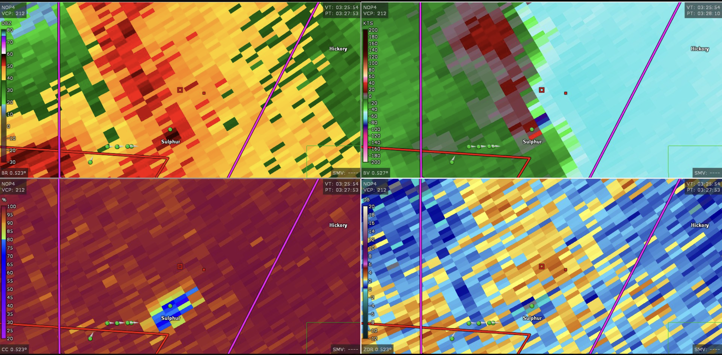
English: This image shows the radar presentation of a damaging tornado in Sulphu,r Oklahoma on April 27, 2024. |
| Date | |
| Source | NEXRAD |
| Author | National Weather Service, Federal Aviation Administration, United States Air Force |
Licensing
This image is in the public domain because it is from one or more of the U.S. government’s 159 NEXRAD radars, which are jointly owned and operated by the National Weather Service (NWS), an agency of the National Oceanic and Atmospheric Administration (NOAA) within the United States Department of Commerce, the Federal Aviation Administration (FAA) within the Department of Transportation, and the U.S. Air Force within the Department of Defense.
Thus all NEXRAD images are public domain.
|
  |
File history
Click on a date/time to view the file as it appeared at that time.
| Date/Time | Thumbnail | Dimensions | User | Comment | |
|---|---|---|---|---|---|
| current | 19:44, 28 April 2024 | | 2,322 × 1,144 (5.03 MB) | Floriangkmcc | Uploaded a work by The National Weather Service from Nexrad Radar with UploadWizard |
File usage
There are no pages that use this file.