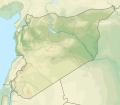
File:Syria physical location map.svg
Appearance

Size of this PNG preview of this SVG file: 685 × 599 pixels. Other resolutions: 274 × 240 pixels | 549 × 480 pixels | 878 × 768 pixels | 1,170 × 1,024 pixels | 2,340 × 2,048 pixels | 921 × 806 pixels.
Original file (SVG file, nominally 921 × 806 pixels, file size: 972 KB)
File history
Click on a date/time to view the file as it appeared at that time.
| Date/Time | Thumbnail | Dimensions | User | Comment | |
|---|---|---|---|---|---|
| current | 14:07, 18 November 2022 |  | 921 × 806 (972 KB) | GrandEscogriffe | more correct N/S stretching |
| 20:40, 23 July 2012 |  | 921 × 761 (788 KB) | NordNordWest | == {{int:filedesc}} == {{Information |Description={{de|Physische Positionskarte von Syrien. De-facto-Situation.}} Quadratische Plattkarte, N-S-Streckung 115 %. Geographische Begrenzung der Karte: * N: 37.6° N * S: 32.0° N * W: 34.9... |
File usage
The following 3 pages use this file:
Global file usage
The following other wikis use this file:
- Usage on als.wikipedia.org
- Usage on ar.wikipedia.org
- نهر السن
- بلودان
- الزبداني
- قالب:خريطة مواقع سوريا
- زلزال حلب (1138)
- بحيرة زرزر
- بحيرة قطينة
- مضايا
- زلزال حماة 1157
- وحدة:Location map/data/Syria
- مستخدم:عبد المؤمن/مسودات/خرائط/الشام
- قائمة الصحفيين القتلى في سوريا
- وحدة:Location map/data/Syria/شرح
- الشعيطات
- الخط الزمني للحرب الأهلية السورية (سبتمبر–ديسمبر 2019)
- الخط الزمني للحرب الأهلية السورية (يناير–أبريل 2020)
- الأغاني الحورية
- رقية حسن محمد
- الانتخابات المحلية في الإدارة الذاتية لشمال وشرق سوريا 2015
- الخط الزمني للحرب الأهلية السورية (2022)
- زلزال قهرمان مرعش 2023
- زلزال حلب 1822
- زلزال سوريا 1170
- زلزال سوريا 1344
- زلزال اللاذقية 1796
- زلزال سوريا 1202
- زلزال الساحل السوري 859
- زلزال أنطاكية 526
- زلزال أميك 1872
- سد محردة
- Usage on arz.wikipedia.org
- Usage on ast.wikipedia.org
- Usage on av.wikipedia.org
- Usage on azb.wikipedia.org
- Usage on az.wikipedia.org
View more global usage of this file.

