
File:Tikal map.JPG
Size of this preview: 566 × 600 pixels. Other resolutions: 226 × 240 pixels | 453 × 480 pixels | 724 × 768 pixels | 966 × 1,024 pixels | 1,600 × 1,696 pixels.
Original file (1,600 × 1,696 pixels, file size: 263 KB, MIME type: image/jpeg)
| This is a file from the Wikimedia Commons. Information from its description page there is shown below. Commons is a freely licensed media file repository. You can help. |
Summary

|
File:Tikal map vector.svg is a vector version of this file. It should be used in place of this JPG file when not inferior.
File:Tikal map.JPG → File:Tikal map vector.svg
For more information, see Help:SVG. |
 |
| Description |
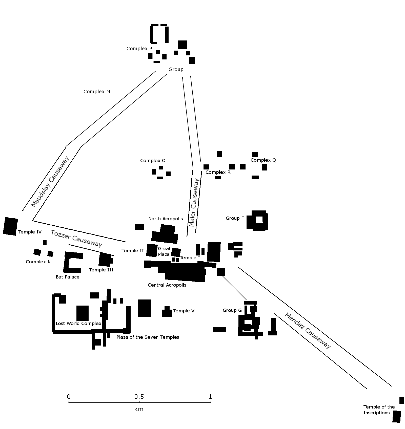
English: Map of the site core of Tikal, showing the major structures of the Mayan site.
Español: Mapa del nucleo de Tikal con las estructuras más importantes. Petén, Guatemala. |
| Date | |
| Source | Own work |
| Author | Simon Burchell |
Licensing
I, the copyright holder of this work, hereby publish it under the following license:
This file is licensed under the Creative Commons Attribution-Share Alike 3.0 Unported license.
- You are free:
- to share – to copy, distribute and transmit the work
- to remix – to adapt the work
- Under the following conditions:
- attribution – You must give appropriate credit, provide a link to the license, and indicate if changes were made. You may do so in any reasonable manner, but not in any way that suggests the licensor endorses you or your use.
- share alike – If you remix, transform, or build upon the material, you must distribute your contributions under the same or compatible license as the original.

|
Permission is granted to copy, distribute and/or modify this document under the terms of the GNU Free Documentation License, Version 1.2 or any later version published by the Free Software Foundation; with no Invariant Sections, no Front-Cover Texts, and no Back-Cover Texts. A copy of the license is included in the section entitled GNU Free Documentation License. |
File history
Click on a date/time to view the file as it appeared at that time.
| Date/Time | Thumbnail | Dimensions | User | Comment | |
|---|---|---|---|---|---|
| current | 22:33, 14 November 2009 | | 1,600 × 1,696 (263 KB) | Simon Burchell | Include northern portion of site core |
| 15:28, 14 November 2009 |  | 1,600 × 1,103 (212 KB) | Simon Burchell | {{Information |Description={{en|1=Map of the site core of Tikal, showing the major structures. Petén, Guatemala.}} {{es|1=Mapa del nucleo de Tikal con las estructuras más importantes. Petén, Guatemala.}} |Source={{own}} |Author=[[User:Simon Burchell|Si |
File usage
There are no pages that use this file.
Global file usage
The following other wikis use this file:
- Usage on en.wikipedia.org
- Usage on pl.wikipedia.org