
File:UttarakhandDistricts numbered.svg

Size of this PNG preview of this SVG file: 666 × 599 pixels. Other resolutions: 267 × 240 pixels | 533 × 480 pixels | 853 × 768 pixels | 1,138 × 1,024 pixels | 2,276 × 2,048 pixels | 1,250 × 1,125 pixels.
Original file (SVG file, nominally 1,250 × 1,125 pixels, file size: 145 KB)
| This is a file from the Wikimedia Commons. Information from its description page there is shown below. Commons is a freely licensed media file repository. You can help. |
Summary
| Description |
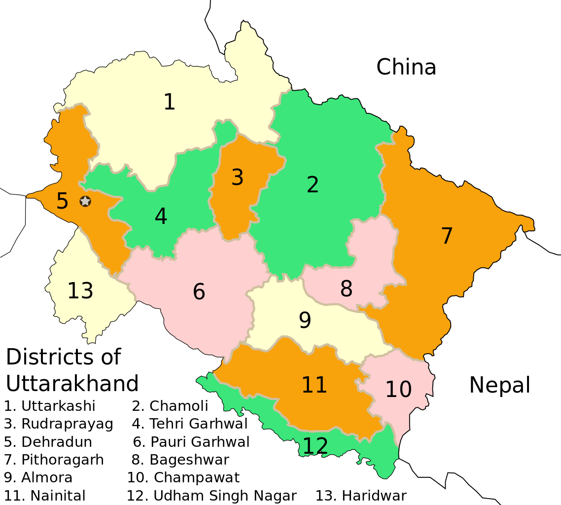
English: Based on File:Uttarakhand_locator_map.svg |
| Date | |
| Source |
This file was derived from: Uttarakhand locator map.svg |
| Author |
|
| Other versions |
[]
|


Licensing
| I, the copyright holder of this work, release this work into the public domain. This applies worldwide. In some countries this may not be legally possible; if so: I grant anyone the right to use this work for any purpose, without any conditions, unless such conditions are required by law. |
This file is licensed under the Creative Commons Attribution 3.0 Unported license.
Attribution: Mkeranat
- You are free:
- to share – to copy, distribute and transmit the work
- to remix – to adapt the work
- Under the following conditions:
- attribution – You must give appropriate credit, provide a link to the license, and indicate if changes were made. You may do so in any reasonable manner, but not in any way that suggests the licensor endorses you or your use.

|
Permission is granted to copy, distribute and/or modify this document under the terms of the GNU Free Documentation License, Version 1.2 or any later version published by the Free Software Foundation; with no Invariant Sections, no Front-Cover Texts, and no Back-Cover Texts. A copy of the license is included in the section entitled GNU Free Documentation License. |
File history
Click on a date/time to view the file as it appeared at that time.
| Date/Time | Thumbnail | Dimensions | User | Comment | |
|---|---|---|---|---|---|
| current | 13:53, 16 January 2009 | | 1,250 × 1,125 (145 KB) | GDibyendu | {{Information |Description=District borders with color d0c0a0 as prescribed in WP India cartography dept in en wikipedia |Source=based on previous version only |Date=2009-01-16 |Author=GDibyendu |Permission= |other_versions= }} |
| 18:53, 15 January 2009 |  | 1,250 × 1,125 (145 KB) | GDibyendu | {{Information |Description={{en|1=Based on File:Uttarakhand_locator_map.svg}} |Source=Own work by uploader |Author=GDibyendu |Date=2009-01-16 |Permission= |other_versions= }} <!--{{ImageUpload|full}}--> |
File usage
The following page uses this file:
Global file usage
The following other wikis use this file:
- Usage on en.wikipedia.org
- Usage on eu.wikipedia.org
- Usage on fr.wikipedia.org
- Usage on gu.wikipedia.org
- Usage on hi.wikipedia.org
- Usage on hr.wikipedia.org
- Usage on id.wikipedia.org
- Usage on ml.wikipedia.org
- Usage on mr.wikipedia.org
- Usage on ne.wikipedia.org
- Usage on new.wikipedia.org
- Usage on pl.wikipedia.org
- Usage on ru.wikipedia.org
- Usage on sat.wikipedia.org
- Usage on sa.wikipedia.org
- Usage on ta.wikipedia.org
- Usage on te.wikipedia.org
- Usage on uk.wikipedia.org
- Usage on ur.wikipedia.org
- Usage on zh.wikipedia.org