Peneda-Gerês National Park
Appearance
| Peneda-Gerês National Park | |
|---|---|
IUCN category II (national park) | |
 A view of the yellowish landscape of the Serra Amarela (Yellow Range) | |
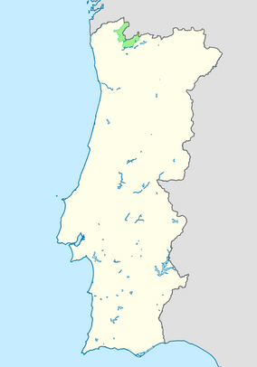
 Location of the Peneda-Gerês National Park within continental Portugal | |
| Location | Norte, Portugal |
| Coordinates | 41°43′49.22″N 8°9′42.05″W / 41.7303389°N 8.1616806°W |
| Length | 45.44 km (28.24 mi) |
| Width | 45.34 km (28.17 mi) |
| Area | 695.93 km2 (268.70 sq mi)[1] |
| Max. elevation | 1,546 m (5,072 ft) |
| Established | May 1971 |
| Named for | The two extreme serras where the national park extends between Serra da Peneda and Serra do Gerês |
| Visitors | 92,777 (2017-2020 average)[2] |
| Governing body | ICNF |
| Website | Parque Natural da Peneda-Gerês |
The Peneda-Gerês National Park (Portuguese: Parque Nacional da Peneda-Gerês, Portuguese pronunciation: [ˈpaɾkɨ nɐsjuˈnaɫ ðɐ pɨˈneðɐ ʒɨˈɾeʃ]), is a national park in northern Portugal. Created on 8 May 1971, it is the oldest protected area and the only national park in Portugal. The park have an area of 695.93 km2 (268.70 sq mi).[3]
References
[change | change source]- ↑ "Peneda-Gerês | DOPA Explorer". dopa-explorer.jrc.ec.europa.eu. Retrieved 30 May 2021.
- ↑ "Número de visitantes que contactaram as áreas protegidas". ICNF. Retrieved 30 May 2021.
- ↑ "Geres-Xures Transboundary Biosphere Reserve, Portugal/Spain". UNESCO. 2019-02-26. Retrieved 26 June 2021.
