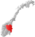
Øystre Slidre
Appearance
Øystre Slidre kommune
Østre Slidre herred (historic) | |
|---|---|
 | |
 Øystre Slidre within Innlandet | |
| Coordinates: 61°14′11″N 9°8′37″E / 61.23639°N 9.14361°E | |
| Country | Norway |
| County | Innlandet |
| Established | 1849 |
| Administrative centre | Heggenes |
| Area | |
| • Total | 969.24 km2 (374.23 sq mi) |
| • Land | 885.51 km2 (341.90 sq mi) |
| • Water | 83.73 km2 (32.33 sq mi) 8.6% |
| • Rank | 120 in Norway |
| Population (2022) | |
| • Total | 3,252 |
| • Rank | 221 in Norway |
| • Density | 3.7/km2 (10/sq mi) |
| • Change (10 years) | 2.5% |
| Demonym | Øystreslidring[1] |
| Time zone | UTC+01:00 (CET) |
| • Summer (DST) | UTC+02:00 (CEST) |
| ISO 3166 code | NO-3453 |
| Official language form | Nynorsk[2] |
| Preceded by | Slidre Municipality |
Øystre Slidre is a municipality in Innlandet county, Norway.
It is in the Valdres traditional district.
Related pages
[change | change source]References
[change | change source]- ↑ "Navn på steder og personer: Innbyggjarnamn" (in Norwegian). Språkrådet.
- ↑ "Forskrift om målvedtak i kommunar og fylkeskommunar" (in Norwegian). Lovdata.no.


